
St. Lucie County · Florida
Pepper Park beach
- State
- Florida
- County
- St. Lucie County
- City / community
- North Hutchinson Island
North Hutchinson Island is a barrier island community in St. Lucie County; it is not an incorporated city.
Treasure Coast · St. Lucie County
A North Hutchinson Island beach for a picnic and a guarded swim when the tower is staffed. Restrooms and recreation facilities make planning easier; reef and wreck visits need a separate conditions check.
Good fit: A North Hutchinson Island beach for a picnic and a guarded swim when the tower is staffed. Restrooms and recreation facilities make planning easier; reef and wreck visits need a separate conditions check.
Plan around: Restroom and tower duty hours remain separate from ocean-access hours.
PLAN THE BASICS
At a glance
- Parking
- Free beach admission & parkingDetails & restrictions
- Dogs
- No pets on county beachDetails & restrictions
- Restrooms
- Restrooms listedDetails & restrictions
- Lifeguards
- Year-round service; check tower hoursDetails & restrictions
- Public access
- Public accessDetails & restrictions
- Beach driving
- Designated roads & parking onlyDetails & restrictions
- Accessibility
- Accessible beach route unverifiedDetails & restrictions
Choose an entrance
Pepper Park beach designated entrance
Choose the signed county beach destination. The parking evidence below gives its named road entrance and any address or capacity caveat.
Official route / restriction details ↗Parking, route & accessibility evidence
Parking & entry: Free beach admission & parking. Use the signed Pepper Park beachside entrance on North SR A1A. The county lists 3302; the older inventory and tourism listing use 3375. Follow the park signs rather than treating either street number as a surveyed entrance. Published whole-park space counts include lagoon parking and disagree; none is assigned to FL1678.
Parking source ↗Accessibility: Accessible beach route unverified. The 2023 management plan describes a proposed accessible boardwalk, not proof of a completed route. Obtain current crossover and restroom-route details before planning wheelchair access.
Accessibility source ↗Open the county entrance directory ↗
Use the directory to check each entrance’s identity and status. Guide map pins are approximate shoreline locations, not turn-by-turn entrance directions or proof of current opening.
Known for
Ocean swimming, picnic facilities and nearby underwater heritage.
Sources & review date
Source ↗ · reviewed 2026-10-03T14:10:55.722Z
Confirm tower duty hours and guarded swimming boundaries on arrival.
Rules & facilities
Check before you go
Check Pepper Park beach’s county page and signs, NWS surf/rip guidance and DOH county results. Verify any essential accessible route and current operating restriction before departure.
Sources & review date
Source ↗ · Additional source ↗ · Additional source ↗ · reviewed 2026-10-03T14:10:55.722Z
Browse all St. Lucie access observations ↗
Admission, payment & passes
Official tourism identifies free admission and parking at non-state-park beaches. Separate services or reservations may cost extra.
Sources & review date
Source ↗ · Additional source ↗ · reviewed 2026-10-03T14:10:55.722Z
What to bring & supporting visit details
Plan your visit
See the entrance section for parking and entry details and sources. Choose the staffed swimming area and confirm restroom and tower hours separately.
Sources & review date
Source ↗ · Additional source ↗ · reviewed 2026-10-03T14:10:55.722Z
Public or private?
Public access
Who can visit: Open to the general public, including visitors, during permitted hours and subject to posted rules.
Entry route, fees & access boundaries
- Manager / access authority
- St. Lucie County
- Access basis
- This listing covers a publicly managed beach access or park, not a private guest-only beach.
- Where to enter
- See the entrance section for parking and entry details and sources.
- Fees & reservations
- Official tourism identifies free admission and parking at non-state-park beaches. Separate services or reservations may cost extra.
- Restrictions & exceptions
- Use the signed designated beach entrance. Preserve access is limited to designated entry points; neighboring private land and lagoon facilities are not interchangeable routes. County Code §32-96 prohibits pets on these county beach areas, subject to its named and statutory exceptions. Walton Rocks is the designated ocean dog-beach option; statutory service-animal rights remain separate. County Code §32-88 exempts this Atlantic ocean access point from the ordinary sunset-to-sunrise closure. That exception does not establish all-night facilities, parking or lifeguards; obey posted restrictions.
- What this label covers
- Approved named entrance membership only; exact outer shoreline boundaries and current temporary opening remain separate.
Beach ownership, the route across land, public shoreline-use rights and access to facilities are separate questions. Rules vary by state and location. Use the identified public entrance or documented permission; neither a nearby resort nor an admission fee by itself establishes that a beach is private. A mapped beach is not permission to cross private property.
Access policy reviewed 2026-10-03. Not a live closure report or a property-boundary survey.
Allowed & prohibited activities
County Code §32-94 prohibits alcohol possession and consumption on covered county property unless the Board expressly permits it.
Sources & review date
Source ↗ · reviewed 2026-10-03T14:10:55.722Z
No ground or beach bonfires. County rules allow fires only in approved suitable facilities; a picnic area is not permission to make a fire on the sand.
Sources & review date
Source ↗ · Additional source ↗ · reviewed 2026-10-03T14:10:55.722Z
This guide offers a day visit, not an approved campsite. County Code §32-90 restricts public camping/sleeping and requires approval for designated campsites; ocean access and vehicle exceptions do not confer overnight parking rights.
Sources & review date
Source ↗ · Additional source ↗ · reviewed 2026-10-03T14:10:55.722Z
Check FWC saltwater license requirements and exemptions before shore fishing; species rules and posted swimming-area restrictions also apply.
Sources & review date
Source ↗ · Additional source ↗ · reviewed 2026-10-03T14:10:55.722Z
- Hours
- Ocean access overnight exception
County Code §32-88 exempts this Atlantic ocean access point from the ordinary sunset-to-sunrise closure. That exception does not establish all-night facilities, parking or lifeguards; obey posted restrictions.
Pepper Park beach · St. Lucie County ↗ - Dogs on the beach
- No pets on county beach
County Code §32-96 prohibits pets on these county beach areas, subject to its named and statutory exceptions. Walton Rocks is the designated ocean dog-beach option; statutory service-animal rights remain separate.
Pepper Park beach · St. Lucie County ↗ - Lifeguards
- Year-round service; check tower hours
Official sources identify lifeguard coverage, with year-round service described by tourism. Exact daily duty hours and guarded boundaries are not established; use the staffed tower and posted instructions.
Pepper Park beach · St. Lucie County ↗ - Restrooms
- Restrooms listed
Restrooms are listed by the county. Their current opening hours, shower availability and the continuous accessible route are separate questions.
Pepper Park beach · St. Lucie County ↗ - Access & beach rules
- Use signed designated entrances
Use the signed designated beach entrance. Preserve access is limited to designated entry points; neighboring private land and lagoon facilities are not interchangeable routes.
Pepper Park beach · St. Lucie County ↗ - Beach driving
- Designated roads & parking only
Use designated roads and parking. County Code §32-93 restricts vehicle use to designated areas; this pedestrian beach entry is not a recreational sand-driving route.
Pepper Park beach · St. Lucie County ↗
Conditions & activities Surf, sand, wildlife and suitability
Conditions at the beach
Saved reports below are dated snapshots, not live conditions. JavaScript refreshes them from official sources when available. Source timestamps and tide times identify their time zone.
Weather observation
Saved report · not live. This dated snapshot may be out of date. Check the official source before your visit.
84°F · Partly Cloudy
- Fort Pierce, St. Lucie County International Airport · nearby reporting station, not a beach sensor.
Observation: 2026-10-03T14:00:00+00:00.
Retrieved: 2026-10-03T14:26:35.870Z.
Live-use expiration: 2026-10-03T16:00:00.000Z. This static copy never certifies current conditions.
UV forecast
No current-hour UV estimate is shown in this saved page. Use sun protection; the live forecast loads when available.
Daily forecast
Saved report · not live. This dated snapshot may be out of date. Check the official source before your visit.
Saved forecast for this beach’s NWS grid
- 2026-10-03T10:00:00-04:00–2026-10-03T18:00:00-04:00: Today · 85°F · Slight Chance Showers And Thunderstorms · wind 10 to 15 mph ESE
- 2026-10-03T18:00:00-04:00–2026-10-04T06:00:00-04:00: Tonight · 80°F · Chance Showers And Thunderstorms · wind 10 to 15 mph ESE
Source issued/updated: 2026-10-03T12:55:48+00:00.
Retrieved: 2026-10-03T14:26:35.865Z.
Live-use expiration: 2026-10-03T22:00:00.000Z. This static copy never certifies current conditions.
High & low tides
Saved prediction · not live. This dated snapshot may be out of date. Check the official source before your visit.
Fort Pierce South Jetty. Inlet tide reference across the inlet; not a measurement at this ocean beach. Predictions, not measured water levels or safe crossing times.
- 2026-10-03 01:34 · High tide
- 2026-10-03 07:51 · Low tide
- 2026-10-03 14:32 · High tide
- 2026-10-03 20:33 · Low tide
- 2026-10-04 02:45 · High tide
- 2026-10-04 09:05 · Low tide
- 2026-10-04 15:41 · High tide
- 2026-10-04 21:45 · Low tide
Prediction dates: 2026-10-03–2026-10-04 · station local time.
Retrieved: 2026-10-03T14:26:35.619Z.
Live-use expiration: 2026-10-04T14:26:35.619Z. This static copy never certifies current conditions.
Fort Pierce South Jetty. Inlet tide reference across the inlet; not a measurement at this ocean beach. Predictions, not measured water levels or safe crossing times.
NOAA tide station ↗NOAA swim & rip-current forecast
Saved report · not live. This dated snapshot may be out of date. Check the official source before your visit.
Forecast rip-current risk: High · Coastal Saint Lucie Beaches
- Surf: Around 3 feet.
- Southeast winds 10 to 15 mph.
- Partly sunny. A chance of showers and thunderstorms.
- Forecast risk is not an observed beach flag.
Source issued/updated: 10/3/2026 300 AM EDT · Today.
Retrieved: 2026-10-03T14:26:35.705Z.
Live-use expiration: 2026-10-04T00:00:00.000Z. This static copy never certifies current conditions.
Forecast risk is not the flag flying at this beach. Conditions can vary within the forecast area.
Official local flag & condition status
Flag color: not currently verified
No dated beach-specific observed flag feed is connected. Managing-authority notices and posted signs control; forecast risk is not an observed flag.
The Beach Database does not convert weather or a rip-current forecast into a colored flag. Check flags and signs on arrival and ask a lifeguard where available.
Weather warnings & alerts
Saved report · not live. This dated snapshot may be out of date. Check the official source before your visit.
Alerts returned at the recorded check
- Rip Current Statement · Rip Current Statement issued October 3 at 1:57AM EDT until October 4 at 4:00AM EDT by NWS Melbourne FL · source expiration 2026-10-04T04:00:00-04:00
Source issued/updated: 2026-10-03T14:23:36+00:00.
Retrieved: 2026-10-03T14:26:35.650Z.
Live-use expiration: 2026-10-03T16:23:36.000Z. This static copy never certifies current conditions.
Weather alerts do not confirm swimming safety, lifeguard staffing, water quality or beach closures. No alert does not mean safe water.
Water quality
Use DOH-St. Lucie beach results. The exact ocean sampling station has not been reconciled to this shoreline; lagoon results and old samples must not be presented as current ocean status.
Sources & review date
Source ↗ · Additional source ↗ · reviewed 2026-10-03T14:10:55.722Z
Crowd meter
No measured beach occupancy series was established from the county page and destination guide. Plan around the named lot and required facilities rather than a numerical crowd score.
Sources & review date
Source ↗ · Additional source ↗ · reviewed 2026-10-03T14:10:55.722Z
Sand & sandcastles
This is an exposed ocean shoreline. Reviewed official descriptions do not provide a field-tested sandcastle score or current beach-width measurement.
Sources & review date
Source ↗ · Additional source ↗ · reviewed 2026-10-03T14:10:55.722Z
Surfing profile
No beach-specific wave-break assessment or tested surfing score was established. Check the regional surf/rip forecast and posted swimmer separation before considering an ocean session.
Sources & review date
Source ↗ · Additional source ↗ · Additional source ↗ · reviewed 2026-10-03T14:10:55.722Z
Beachcombing
Enjoy a shore walk without expecting a verified shell yield. County resource-protection rules apply; a shelling mention is not permission to remove protected material or living wildlife.
Sources & review date
Source ↗ · Additional source ↗ · Additional source ↗ · reviewed 2026-10-03T14:10:55.722Z
The reviewed named county and destination sources do not establish this as a dependable shark-tooth destination. No tooth-hunting rating is assigned.
Sources & review date
Source ↗ · Additional source ↗ · Additional source ↗ · reviewed 2026-10-03T14:10:55.722Z
Snorkeling & scuba diving
The county describes nearby reefs and underwater heritage, but this does not establish a verified easy shore-entry dive route. Nearby reefs and the Urca de Lima wreck are different targets. The dated 2017 NPS description places the wreck north of Pepper at 10–15 feet; county wording describes about 20 feet. No approved shore-dive route is established.
Sources & review date
Source ↗ · Additional source ↗ · reviewed 2026-10-03T14:10:55.722Z
The county describes nearby reefs and underwater heritage, but this does not establish a verified easy shore-entry dive route. Nearby reefs and the Urca de Lima wreck are different targets. The dated 2017 NPS description places the wreck north of Pepper at 10–15 feet; county wording describes about 20 feet. No approved shore-dive route is established.
Sources & review date
Source ↗ · Additional source ↗ · reviewed 2026-10-03T14:10:55.722Z
Shore & sky wildlife
St. Lucie County identifies its ocean beaches as nesting habitat for loggerhead, green and leatherback turtles. This county-scoped context is not a guaranteed species sighting at this entrance.
Sources & review date
Source ↗ · Additional source ↗ · reviewed 2026-10-03T14:10:55.722Z
History & interesting facts
The nearby Urca de Lima wreck belongs to the 1715 Spanish fleet and became an underwater archaeological preserve. It is offshore; this guide does not assign the wreck to the beach entrance or recommend collecting artifacts.
Sources & review date
Source ↗ · Additional source ↗ · reviewed 2026-10-03T14:10:55.722Z
A closer look
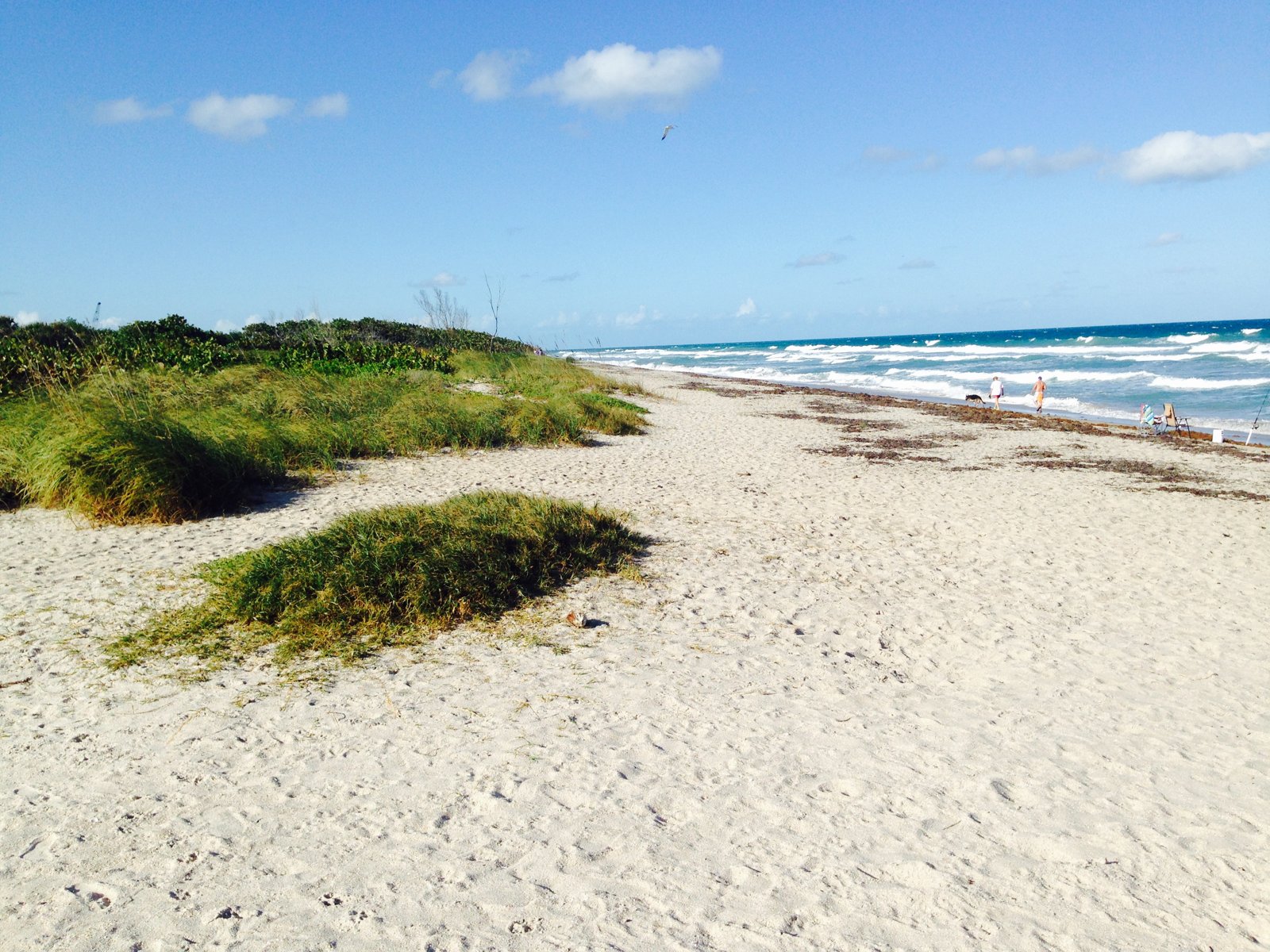
Photos of this beach and its surroundings. Select a photo to view it larger. These are recorded views, not live conditions.
 View larger ↗
Hutchinson Island, St. Lucie County — regional fallback photograph; not verified as Pepper Park beach. Archival scenery, not current conditions or facilities.
Capture date not confirmedFile:Hutchinson Island, FL, USA - panoramio (10).jpg · William “Patrick” Ma… · CC BY-SA 3.0
Resized/cropped for display; original colors retained. Adaptations retain the stated license.
Food, stays & rentals
EXTEND YOUR BEACH DAY
Food & drink nearby
On the Edge Bar & Grill
On the Edge, 1136 Seaway Drive, is a waterfront meal option across the inlet; drive via mainland bridges, not across the water.
On the Edge Bar & Grill source & location details ↗Accommodations by the beach
Hutchinson Island Hotel & Suites, 1230 Seaway Drive, is across the inlet; reach it by road via the mainland.
Sources & review date
Source ↗ · reviewed 2026-10-03T14:10:55.722Z
Activities & rentals
Sunrise City Adventures offers kayak rentals and self-launch for visitors’ own canoe, kayak or SUP at 905 Shorewinds Drive in Fort Pierce Inlet State Park. This is a separately booked lagoon outing, not delivery or an ocean launch at this entrance.
Sources & review date
Source ↗ · Additional source ↗ · reviewed 2026-10-03T14:10:55.722Z
Explore nearby beaches
Sources & review date
Guide desk research reviewed 2026-10-03; this is not a field-by-field current verification or an on-site inspection. Official facts, dated agency evidence and editorial assessments retain their own scope. Unknowns and conflicts remain open. Methodology · Rating explanations · Correction history
Photo: File:Hutchinson Island, FL, USA - panoramio (10).jpg by William “Patrick” Ma… · CC BY-SA 3.0. Cropped for display; adaptations retain this license. Regional photograph, not this specific beach.
.jpg)
Visitor experiences
Original, moderated reviews and photographs. Visit dates and entrances provide context; visitor ratings and reports do not replace official facts or current conditions.
Read approved visitor experiences here when available.