
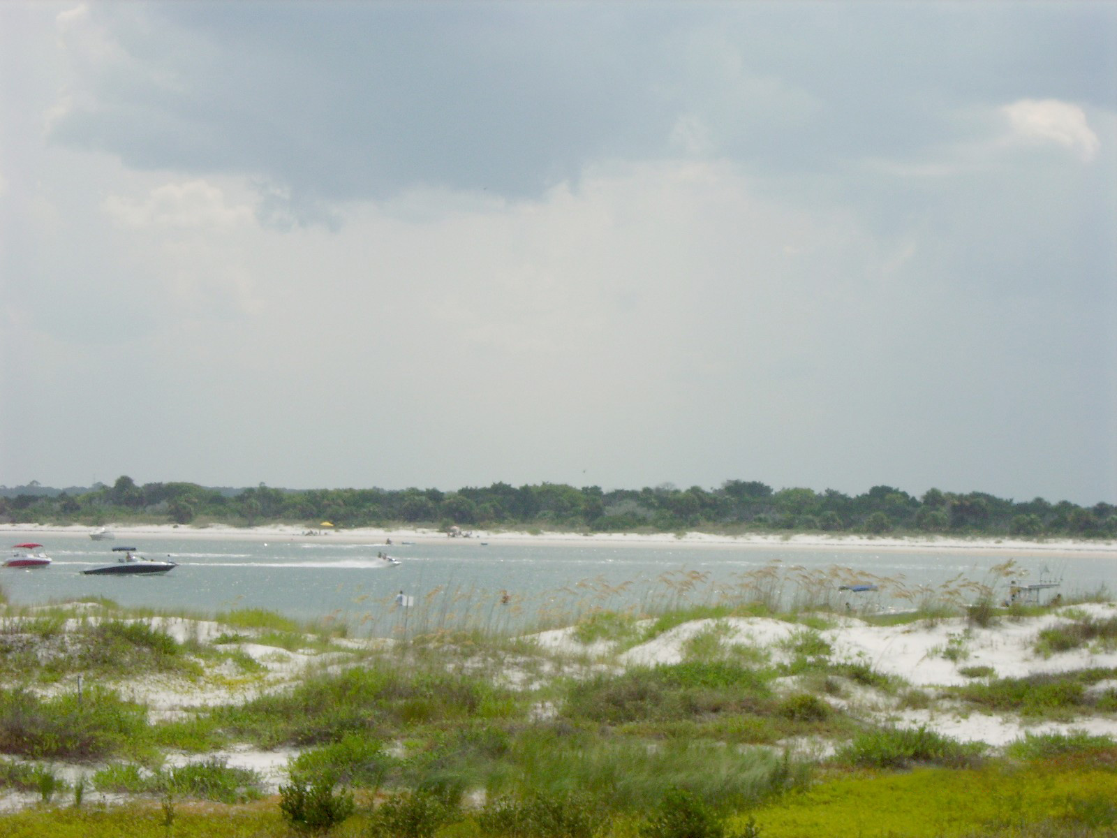
St. Johns County Coast · Florida
Fort Matanzas Beach & Inlet
- State
- Florida
- County
- St. Johns County
- City / community
- St. Augustine
This beach is in unincorporated St. Johns County.
Northeast Florida · St. Johns County Coast
Fort Matanzas protects shoreline on both sides of the inlet. The ocean boardwalks and river access are separate from the visitor-center ferry experience, and inlet currents can be severe.
Good fit: Atlantic and river beaches within Fort Matanzas National Monument, with free public access and two ocean-side parking lots.
Plan around: Choose your entrance before setting off: facilities and restrictions vary along the shoreline.
- Parking
- Free public access
Details & sources
- Dogs
- Unknown · clarification pending
Details & sources
Leashed dogs welcome · 6-foot leash
NPS permits pets on a leash no longer than six feet on the beach and trails. Remove waste. Pets other than service animals are excluded from the visitor center, boat and fort. The NPS page was last updated May 11, 2020 and was re-fetched October 6, 2026; posted closures and current park restrictions still govern.
Fort Matanzas National Monument pet rules ↗ - Restrooms
- Unknown · clarification pending
Details & sources
Seasonal portable restrooms near ocean accesses
Permanent accessible restrooms are at the visitor center across A1A during its operating hours.
St. Johns County · Beach access details ↗ - Lifeguards
- Seasonal
Details & sources
Seasonal county tower near northern access
Memorial Day weekend through Labor Day weekend; NPS beaches otherwise should be treated as unguarded.
St. Johns County · Beach access details ↗ - Key restrictions
- Check before you go
Details & sources
No alcohol, glass containers, overnight camping or open fires. Contained cooking fires on the beach are allowed only in devices designed for cooking; remove all coals and obey the monument’s fuel and disposal restrictions. Use designated trails and stay out of protected dunes. Drones require written authorization. Smoking is prohibited in the named buildings, ferry and fort areas and within 25 feet of entrances, exits and operable windows; confirm any additional posted beach restrictions. Do not dispose of coals, briquettes, embers or previously heated objects on the beach, dunes, conservation areas or in trash receptacles. Do not use flammable liquids, garbage, fireworks, plastics, aerosol canisters, batteries or other manufactured or synthetic material to light or maintain a fire. Cooking equipment at the visitor-center picnic area requires written permission from the superintendent.
Fort Matanzas superintendent compendium ↗ - Best for
- See beach overview
Beach overview
Atlantic and river beaches within Fort Matanzas National Monument, with free public access and two ocean-side parking lots.
Sources & review dates
More planning facts: access, driving & fees
- Public access
- Public accessDetails & restrictions
- Beach driving
- NoDetails & restrictions
- Accessibility
- Accessible ocean and river boardwalksDetails & restrictions
Choose an entrance
Free public access. Check the route and parking details below, then choose an entrance in the county directory.
Parking, route & accessibility evidence
Parking & entry: Free public access. Two ocean-side lots are listed at 8635 and 8825 A1A South. Parking is limited; oversized vehicles cannot use the visitor-center lot.
Parking source ↗Accessibility: Accessible ocean and river boardwalks. NPS describes the boardwalks as accessible. Sand beyond the boardwalk is a separate surface.
Accessibility source ↗Open the county entrance directory ↗
Use the directory to check each entrance’s identity and status. Guide map pins are approximate shoreline locations, not turn-by-turn entrance directions or proof of current opening.
WHY THIS BEACH STANDS OUT
Known for
Highly rated
Standout for surfing
Rated 4/5 for surfing. Powerful Matanzas Inlet surf zone. Check the current report, wind and rip-current information before entering.
Shown only for unusually strong ratings or a distinctive, well-documented feature. Live conditions, rules and availability can change.
Matanzas Inlet currents are extremely strong. A calm-looking channel is not a protected swimming area.
Rules & facilities
Check before you go
Swimming flag: no dated location-specific official flag report is connected for this guide. Do not infer a flag from the regional rip-current forecast; verify flags and signs on arrival.
Closures and access: check St. Johns County beach updates for the named access, managing park or city. A countywide notice is not automatically beach-specific.
Water quality: the nearest same-county Florida Healthy Beaches station, distance disclosure and dated sample appear in Conditions & activities as dated saved results and refresh from the verified snapshot when available. A nearby station is context, not a sample taken at this beach.
Forecast context: the NWS surf-zone forecast and NOAA tide prediction in that section are regional planning tools, not current water measurements or permission to enter.
Compare Northeast Florida beach dog rules ↗
Browse all 171 St. Johns County mapped beach-access records ↗
What to bring & supporting visit details
Plan your visit
Getting from the car to the coast, and what to bring. Nearby services are distinguished from facilities at this beach.
Shade & picnic areasBring personal sun protection
No beach-wide promise of shade is made. Use a listed pavilion only where the beach page identifies one, and expect the open sand to be unshaded.
St. Johns County · Beach access surfaces ↗Drinking waterBring drinking water
No beach-wide bottle-refill service is listed. Bring potable water; showers and restroom sinks are not presented as refill stations.
St. Johns County · Beach access surfaces ↗Concessions & suppliesPack supplies for the monument shoreline
No ocean-side food concession is listed. Nearby Crescent/Butler dining requires a separate drive; confirm visitor-center rules and hours.
Listed nearby dining: Paladar Cuban Eatery, The Elkhouse Eatery, A1A Asian Kitchen. See Food & drink nearby below for locations and official links.
St. Johns County · Beach access surfaces ↗Beach chairs & umbrellasNo on-site ocean-beach rental assumed
Use only an operator and meeting point that NPS and local rules allow; regional options are listed below for separate outings.
Visit St. Augustine · coastal regions and visitor services ↗Cell servicePlan for patchy reception
Reliable, recent carrier-specific reception at this beach has not been verified. Check your carrier or the FCC mobile map for this location; modeled coverage is not a beach signal test. Save your route and access instructions offline before visiting.
FCC · How to use mobile coverage maps ↗Reviewed September 29, 2026. Unknown means unverified, not absent. Distances are published reference values where stated, not a current route survey. Services and equipment availability can change. Rental links are unpaid; no affiliate commission is included.
Public or private?
Public access
Who can visit: Open to the general public, including visitors, during permitted hours and subject to posted rules.
Entry route, fees & access boundaries
- Manager / access authority
- National Park Service
- Access basis
- This listing covers a publicly managed beach access or park, not a private guest-only beach.
- Where to enter
- Use the signed ocean or river parking areas and raised boardwalks within Fort Matanzas National Monument.
- Fees & reservations
- No entrance or parking fee. Free first-come ferry boarding passes are separate from ordinary beach access.
- Restrictions & exceptions
- NPS shoreline hours and resource rules apply. Off-road driving is prohibited on monument beaches; inlet currents are hazardous.
- What this label covers
- The named park or beach entrance and its designated visitor areas. Adjacent land ownership and exact shoreline boundaries are not surveyed in this guide.
Beach ownership, the route across land, public shoreline-use rights and access to facilities are separate questions. Rules vary by state and location. Use the identified public entrance or documented permission; neither a nearby resort nor an admission fee by itself establishes that a beach is private. A mapped beach is not permission to cross private property.
- National Park Service · Fort Matanzas beach access ↗
- National Park Service · Fort Matanzas visitor information ↗
Access policy reviewed 2026-09-23. Not a live closure report or a property-boundary survey.
Allowed & prohibited activities
Rules for this beach. Campgrounds, restaurants and picnic areas may have different permissions.
- Alcohol
- Check local detailsFollow National Park Service rules
No beach-specific alcohol authorization was found; obey posted monument rules and federal regulations.
- Bonfires & beach fires
- Not allowedNo beach fires documented
Do not build a shoreline fire; use only facilities expressly designated by the National Park Service.
- Beach camping
- Not allowedNo overnight beach camping
The monument closes public areas overnight and does not provide beach camping.
- Shore fishing
- With restrictionsShore fishing allowed outside posted dock area
A Florida saltwater license is required unless exempt. Fishing is prohibited beside the ferry docks and must avoid swimmers.
Shore fishing: licenses & responsible casting
Unless exempt, you need the appropriate Florida saltwater fishing license even when fishing from shore. Eligible Florida residents can obtain a no-cost shoreline license; nonresidents need a nonresident saltwater license unless an exemption applies. A license does not override local closures or swimming-area restrictions.
Check FWC’s current species, size, season and bag limits. Targeting sharks from shore has additional permit and gear requirements. Keep hooks and lines away from swimmers and wildlife, and take discarded tackle home.
Rules reviewed 2026-09-22. Check official notices for temporary closures and burn bans before your visit. Other access, pet and driving rules appear below.
- Hours
- Ocean lots: 6 a.m. – midnight
The visitor-center grounds and river beach have shorter 9 a.m.–5:30 p.m. hours. Holiday closures apply there.
National Park Service · Fort Matanzas public-use hours ↗ - Dogs on the beach
- Leashed dogs welcome · 6-foot leash · 6-foot leash
NPS permits pets on a leash no longer than six feet on the beach and trails. Remove waste. Pets other than service animals are excluded from the visitor center, boat and fort. The NPS page was last updated May 11, 2020 and was re-fetched October 6, 2026; posted closures and current park restrictions still govern.
Fort Matanzas National Monument pet rules ↗ - Lifeguards
- Seasonal county tower near northern access
Memorial Day weekend through Labor Day weekend; NPS beaches otherwise should be treated as unguarded.
St. Johns County · Beach access details ↗ - Restrooms
- Seasonal portable restrooms near ocean accesses
Permanent accessible restrooms are at the visitor center across A1A during its operating hours.
St. Johns County · Beach access details ↗ - Access & beach rules
- National-monument rules apply
No alcohol, glass containers, overnight camping or open fires. Contained cooking fires on the beach are allowed only in devices designed for cooking; remove all coals and obey the monument’s fuel and disposal restrictions. Use designated trails and stay out of protected dunes. Drones require written authorization. Smoking is prohibited in the named buildings, ferry and fort areas and within 25 feet of entrances, exits and operable windows; confirm any additional posted beach restrictions. Do not dispose of coals, briquettes, embers or previously heated objects on the beach, dunes, conservation areas or in trash receptacles. Do not use flammable liquids, garbage, fireworks, plastics, aerosol canisters, batteries or other manufactured or synthetic material to light or maintain a fire. Cooking equipment at the visitor-center picnic area requires written permission from the superintendent.
Fort Matanzas superintendent compendium ↗ - Beach driving
- No off-road driving on NPS beach
A county-operated ramp at the north edge can serve as an exit from the permitted county driving zone; motor vehicles are prohibited on the monument shoreline south of it.
National Park Service · Fort Matanzas beach access ↗
Conditions & activities Surf, sand, wildlife and suitability
Conditions at the beach
Saved reports below are dated snapshots, not live conditions. JavaScript refreshes them from official sources when available. Source timestamps and tide times identify their time zone.
Weather observation
Saved report · not live. This dated snapshot may be out of date. Check the official source before your visit.
66°F · Sky description unavailable
- Flagler County Airport · nearby reporting station, not a beach sensor.
Observation: 2026-11-07T11:35:00+00:00.
Retrieved: 2026-11-07T12:13:27.704Z.
Live-use expiration: 2026-11-07T13:35:00.000Z. This static copy never certifies current conditions.
UV forecast
No current-hour UV estimate is shown in this saved page. Use sun protection; the live forecast loads when available.
Daily forecast
Saved report · not live. This dated snapshot may be out of date. Check the official source before your visit.
Saved forecast for this beach’s NWS grid
- 2026-11-07T07:00:00-05:00–2026-11-07T18:00:00-05:00: Today · 73°F · Mostly Sunny · wind 12 to 15 mph N
- 2026-11-07T18:00:00-05:00–2026-11-08T06:00:00-05:00: Tonight · 67°F · Mostly Clear · wind 7 to 13 mph NE
Source issued/updated: 2026-11-07T11:51:42+00:00.
Retrieved: 2026-11-07T12:13:27.780Z.
Live-use expiration: 2026-11-07T23:00:00.000Z. This static copy never certifies current conditions.
High & low tides
Saved prediction · not live. This dated snapshot may be out of date. Check the official source before your visit.
St. Augustine Beach. County Atlantic reference; timing and heights vary by beach and inlet. Predictions, not measured water levels or safe crossing times.
- 2026-11-07 06:21 · High tide
- 2026-11-07 12:39 · Low tide
- 2026-11-07 18:40 · High tide
- 2026-11-08 00:36 · Low tide
- 2026-11-08 07:03 · High tide
- 2026-11-08 13:23 · Low tide
- 2026-11-08 19:23 · High tide
Prediction dates: 2026-11-07–2026-11-08 · station local time.
Retrieved: 2026-11-07T12:13:26.284Z.
Live-use expiration: 2026-11-08T12:13:26.284Z. This static copy never certifies current conditions.
St. Augustine Beach. County Atlantic reference; timing and heights vary by beach and inlet. Predictions, not measured water levels or safe crossing times.
NOAA tide station ↗NOAA swim & rip-current forecast
Saved report · not live. This dated snapshot may be out of date. Check the official source before your visit.
Forecast rip-current risk: High · Southeast Coastal St. Johns Beaches
- Surf: 4 to 5 feet.
- North winds around 10 mph.
- Mostly sunny.
- Forecast risk is not an observed beach flag.
Source issued/updated: 11/7/2026 500 AM EST · Today.
Retrieved: 2026-11-07T12:13:24.596Z.
Live-use expiration: 2026-11-08T00:00:00.000Z. This static copy never certifies current conditions.
Forecast risk is not the flag flying at this beach. Conditions can vary within the forecast area.
Official local flag & condition status
Flag color: not currently verified
The county publishes access and driving updates through SJC Beaches. A colored swimming flag is not assumed from those notices.
The Beach Database does not convert weather or a rip-current forecast into a colored flag. Check flags and signs on arrival and ask a lifeguard where available.
Weather warnings & alerts
Saved report · not live. This dated snapshot may be out of date. Check the official source before your visit.
Alerts returned at the recorded check
- Rip Current Statement · Rip Current Statement issued November 7 at 12:53AM EST until November 9 at 7:00AM EST by NWS Jacksonville FL · source expiration 2026-11-09T07:00:00-05:00
Source issued/updated: 2026-11-07T12:11:21+00:00.
Retrieved: 2026-11-07T12:13:27.592Z.
Live-use expiration: 2026-11-07T14:11:21.000Z. This static copy never certifies current conditions.
Weather alerts do not confirm swimming safety, lifeguard staffing, water quality or beach closures. No alert does not mean safe water.
Water quality
Official beach bacteria testing · Florida Healthy Beaches
Official sampling point at or immediately beside this guide location; results describe the sampled water only. Reference distance: 0.2 miles.
Saved laboratory results · not a current advisory check
MATANZAS INLET
Historical result · Good
Sample collected: 2026-11-03 · 4 days ago. Sample time of day was not supplied by this report.
Enterococci: 4 per 100 mL.
Advisory in this sample report: No. Current status is not established by this older report.
Official report retrieved 2026-11-07T12:13:49.747Z. Sample dates are shown separately. This saved copy may be out of date; check current advisories.
Official St Johns County results ↗ · About Florida Healthy Beaches ↗
What these results mean
Enterococci are bacteria used to indicate possible fecal contamination. Florida describes 0–35 per 100 mL as Good, 36–70 as Moderate, and 71 or more as Poor. These are periodic laboratory samples, not continuous monitoring.
The Beach Database checks the official report daily, but Florida’s sampling schedule is generally weekly or biweekly. The check time and laboratory sample date are different. Samples more than 14 days old are marked older; that reminder is not an official advisory threshold.
A nearby station is identified by name and distance. Its result is context, not a sample taken at this beach. Testing does not rule out all pathogens, harmful algae, sewage spills or other hazards. Follow current posted advisories and closures.
Crowd meter
Typical atmosphere estimate · not live occupancy. NPS identifies weekends and holidays as busiest.
The monument reports its busiest periods as weekends, holidays and spring school-visitation months. Shoreline use varies by lot.
Busy days, times & seasonsPlan around weekends, holidays and local activity
Days: Planning estimate: fair-weather Saturdays, Sundays and summer holiday weekends are more likely to be busy than ordinary weekdays. No day-by-day attendance series has been verified.
Time of day: Planning estimate: late morning through midafternoon is the main beach-day window. Try the first part of the permitted opening hours for a quieter visit; no measured hourly peak is available.
Time of year: Regional planning estimate: expect more beach-day demand from late May through early September, especially Memorial Day, Independence Day and Labor Day weekends. March–April school breaks can add visitors. Cooler November–February weekdays are a better quiet-time bet, except holidays and events.
Find a quieter visitWhere people gather & when to try
Visit early on a weekday. Limited parking can fill before the beach itself feels crowded.
Within this beach: Ocean boardwalks, inlet fishing areas and the visitor-center ferry area can each gather visitors.
Quieter does not mean safer swimming or staffed lifeguards. Use posted opening hours, weather guidance and access restrictions when choosing a time.
How the meter works & sources
1 = very quiet; 2 = laid-back; 3 = moderate; 4 = lively / busy; 5 = very busy. Higher means more activity, not a better beach. Ratings compare the general daytime experience near the featured access in fair beach weather, mainly during the warm season outside major holidays. They are editorial estimates based on the evidence described above, not measured occupancy percentages or forecasts.
Weekends, events, tides and the exact part of the beach can change the experience. Parking pressure is distinguished from crowding on the sand. No beach is promised to be deserted. A not-applicable result is reserved for a closed, undeveloped or restricted destination where a public-use estimate would mislead. General timing advice is labeled as a planning estimate wherever local attendance data is unavailable.
Reviewed September 22, 2026. No live crowd tracking or hourly visitor counts are connected.
Sand & sandcastles
Dynamic inlet sand. Tap a topic for texture, comfort and family sand-play advice.
Color, texture & shellsDynamic inlet sandNational-monument beach and habitat description
The inlet and Atlantic shore are active sand environments; exact color and shell concentration change with water movement.
Expect shifting bars, shell fragments and steep or cut banks after storms. Firm-looking inlet sand can be exposed to fast currents.
Barefoot comfort, kids & castlesBetter for shoreline exploring than unsupervised water playPractical guidance · not a field-tested rating
Underfoot: For a barefoot walk, look for a clear patch rather than a shell line. Bring sandals for hot sand and any rough fragments. Firmer damp sand can be easier to walk on, but does not establish a wheelchair or stroller route.
Sand play: Try a bucket test: damp sand that holds its shape when tipped out is a good starting point. Pick a shell-light patch away from the active surf, dunes and marked nests. Add a little water to crumbly sand rather than building at the water’s edge.
Sand can become hot regardless of color. Check it before children sit or go barefoot. Tides, storms and beach nourishment can change the surface; these descriptions are not live condition reports or swimming-safety ratings.
Use open beach sand, leave dunes and nesting areas alone, fill holes and flatten castles before leaving so turtles have a clear path. FWC beach-care guidance ↗
Desk review: September 22, 2026. Local observations and sand samples are still needed where noted.
Surfing profile
A long-term assessment for this shoreline, paired with the live NOAA surf and wind information near the top of this page.
- Break type
- Atlantic beach and inlet-influenced sandbars
- Best suited to
- Advanced surfers with inlet experience
Matanzas can produce recognized surf peaks, but this is an inlet environment rather than a routine beginner beach. Use the Atlantic side, observe from shore and avoid channels and ferry areas.
Watch for: Extremely strong inlet current, shifting shoals, boats, no year-round guard and changing sandbars.
Current reports, cameras & social updates
Use the newest time-stamped report. A camera or local post can show shore conditions that a regional model misses; an offshore buoy does not equal breaking-wave height at this access.
Editorial suitability rating reviewed September 23, 2026. It describes the location, not today’s wave quality or safety.
SEARCH THE SHORE
Beachcombing
ShellingProvisional · county coquina contextExplore finds & tips
Quality & what to expect
Worth checking tide lines on a shell-influenced St. Johns County shore. The rating is provisional because whole-shell quality has not been measured at this exact entrance.
Shell types & likely finds
Coquina fragments are expected; a reliable access-specific list of intact common shells is still being built.
How to look
Walk the exposed shell lines around low tide and compare several patches of wet sand. Return after rough weather only when conditions are safe. A beach full of fragments may yield few intact shells.
Collect thoughtfully
Leave living or occupied shells and live sand dollars where they are. Stay off dunes and outside wildlife closures. Use surface beachcombing; this guide does not authorize digging or entering restricted land.
Desk review: September 22, 2026
Shark tooth huntingProvisional · regional possibilityExplore finds & tips
Your chances of finding teeth
An occasional-find prospect rather than a documented hotspot. Search dark gravel and shell lines after tides and storms.
Tooth types & likely finds
No access-specific common shark-tooth type list has been verified, so species are intentionally not guessed.
How to look
Slow down at patches of shell grit and scan for small triangular or needle-like teeth. Try exposed tide lines around low tide; finding nothing on a visit is possible even at a well-known beach.
Collect thoughtfully
Leave living or occupied shells and live sand dollars where they are. Stay off dunes and outside wildlife closures. Use surface beachcombing; this guide does not authorize digging or entering restricted land.
Desk review: September 22, 2026
Snorkeling & scuba diving
Ratings use local St. Johns County evidence and apply to entry from this beach. Offshore boat diving is separate.
SnorkelingShore snorkeling is not yet rated for Fort Matanzas Beach & Inlet.Visibility, wildlife & rentals +
What to expect
Shore snorkeling is not yet rated for Fort Matanzas Beach & Inlet. The reviewed St. Johns County sources do not establish a sheltered, reliably clear snorkeling area or shore-access reef here. Calm water alone does not establish good snorkeling.
Underwater visibility
Typical visibility is not yet assessed for Fort Matanzas Beach & Inlet. No reliable beach-specific visibility range was found in the reviewed St. Johns County sources. Surf can suspend sand, and surface color is not an underwater visibility measurement.
Fish & sea life
The reviewed St. Johns County sources support local marine-habitat context but not a beach-specific underwater sighting census for Fort Matanzas Beach & Inlet. Fish and other sea life vary with season, water, depth and habitat; no species is promised.
Entry, conditions & experience
Use only signed public water-access areas at Fort Matanzas Beach & Inlet and obey current flags and closures. Avoid fishing lines, surfers, piers and boat traffic. This rating does not confirm scuba permission or certify an entry route.
This is not a designated beginner snorkeling recommendation. Go with a buddy and skip unsafe conditions.
Equipment rental nearby
No beach-specific snorkeling or dive-equipment concession was verified in the county sources reviewed. Check the separately researched Activities & rentals section for local operators, and confirm equipment, meeting point and water-entry rules before booking.
Scuba divingShore scuba is not yet rated for Fort Matanzas Beach & Inlet.Visibility, wildlife & rentals +
What to expect
Shore scuba is not yet rated for Fort Matanzas Beach & Inlet. The reviewed St. Johns County sources do not establish a recreational shore-entry route, depth profile or underwater attraction here. County offshore reefs are separate boat destinations.
Underwater visibility
Typical visibility is not yet assessed for Fort Matanzas Beach & Inlet. No reliable beach-specific visibility range was found in the reviewed St. Johns County sources. Surf can suspend sand, and surface color is not an underwater visibility measurement.
Fish & sea life
The reviewed St. Johns County sources support local marine-habitat context but not a beach-specific underwater sighting census for Fort Matanzas Beach & Inlet. Fish and other sea life vary with season, water, depth and habitat; no species is promised.
Entry, conditions & experience
Use only signed public water-access areas at Fort Matanzas Beach & Inlet and obey current flags and closures. Avoid fishing lines, surfers, piers and boat traffic. This rating does not confirm scuba permission or certify an entry route.
Use a trained buddy and stay within your certification. No recommended shore-dive route is established here.
Equipment rental nearby
No beach-specific snorkeling or dive-equipment concession was verified in the county sources reviewed. Check the separately researched Activities & rentals section for local operators, and confirm equipment, meeting point and water-entry rules before booking.
Shore & sky wildlife
Local St. Johns County evidence for animals on the sand, dunes and in the air. Underwater species are covered separately.
Birds on the shore & in the skyShorebirds & beach-nesting birdsSt. Johns County habitat evidence
St. Johns County identifies sensitive shorebirds and their nesting and feeding habitat. Species at Fort Matanzas Beach & Inlet change by season and tide; use posted buffers rather than treating this as a beach-specific census.
Sea turtles on the beachLoggerhead, green & leatherback turtlesSt. Johns County nesting evidence
St. Johns County documents sea-turtle nesting from May 1 through October 31. The source does not establish an active nest or equal species frequency at Fort Matanzas Beach & Inlet.
Other shore & dune wildlifeAnastasia Island beach mice & dune wildlifeSt. Johns County protected-habitat context
The county identifies the Anastasia Island beach mouse and other protected species as dependent on beach and dune habitat. That is habitat context, not a promise of a sighting at Fort Matanzas Beach & Inlet.
Wild horsesNo wild herd documentedSt. Johns County beach context
St. Johns County regulates permitted horseback riding as recreation. It does not document a free-roaming wild-horse herd at Fort Matanzas Beach & Inlet.
- Sand & shoreline
- Dynamic inlet sand
National-monument beach and habitat description. See Sand & sandcastles for details.
National Park Service · Fort Matanzas beaches ↗ - Surfing
- Powerful Matanzas Inlet surf zone
Atlantic beach and inlet-influenced sandbars. Advanced surfers with inlet experience. See the surfing profile and current reports for details.
Surf Station · St. Augustine daily local surf report ↗ - Water
- Atlantic Ocean
Surf, currents and clarity change with weather, tides and inlet proximity. This is not a live safety report.
Water clarity & shore snorkeling
Typical clarity: Not yet assessed. We do not yet have enough beach-specific evidence to describe typical underwater visibility. This does not mean the water is cloudy.
Shore snorkeling not yet assessed. A shore-snorkeling recommendation has not been established for this beach. Check the snorkeling section for access and restrictions.
Typical clarity describes how easily you may see through the water. It does not establish bacterial water quality, safe swimming, calm conditions or visibility today.
Evidence, location scope & review
Desk review 2026-10-06 · This named beach; neighboring beaches, offshore reefs and bacterial sample results excluded. This is not an on-site inspection or a current conditions report.
No beach-specific seasonal/tidal visibility pattern verified.
Named beach only; county offshore diving not inherited
Find clear-water and shore-snorkeling options ↗ · Report a change ↗
Food, stays & rentals
EXTEND YOUR BEACH DAY
Food & drink nearby
Local dining recommendations
Cuban
Paladar Cuban Eatery
5575 A1A South · Butler Beach area In the Butler Beach commercial area; a drive from Crescent and southern accesses.
Visit Paladar Cuban Eatery website ↗Website & source check
Website checked ↗ · Supporting source 2 ↗ · Supporting source 3 ↗ · checked 2026-10-06. Current direct official page retrieved and archived; verification establishes operator identity/link, not today's service availability.
restaurant / bar
The Elkhouse Eatery
6357 A1A South. A dinner restaurant focused on seasonal seafood, steaks and wild game; it is along A1A north of the main park.
Visit The Elkhouse Eatery website ↗Website & source check
Website checked ↗ · checked 2026-10-06. Current direct official page retrieved and archived; verification establishes operator identity/link, not today's service availability.
restaurant / bar
A1A Asian Kitchen
6975 A1A South, beside the Crescent Beach community’s main A1A corridor. Thai, Japanese and Vietnamese dishes, sushi and a full bar; verify current hours and events.
Visit A1A Asian Kitchen website ↗Website & source check
Website checked ↗ · checked 2026-10-06. Current direct official page retrieved and archived; verification establishes operator identity/link, not today's service availability.
These listings are unpaid and contain no affiliate links.
Accommodations by the beach
Verified coastal stays and nearby alternatives. Location labels distinguish oceanfront property, across-A1A lodging and regional options; confirm your exact room or rental unit.
Condo hotelBeacher’s Lodge Oceanfront SuitesOceanfront · Regional alternative · Crescent Beach
Location: 6970 A1A South · Crescent Beach
Ocean view: The property describes every rental suite as oceanfront with an Atlantic-facing patio or private balcony; individual layouts and sightlines still vary.
Direct beach access and an oceanfront pool. Units are individually owned, so compare the exact suite, current photos and scheduled property-work notices before booking.
Website/source checked 2026-10-06.
Cottages & suitesThe Silver SandsOceanfront · Regional alternative · Crescent Beach
Location: 8448 A1A South · Crescent Beach
Ocean view: Five accommodations share an oceanfront dune property; exact water views differ by cottage or suite.
A small, self-catered property with a private boardwalk to Crescent Beach. Confirm the selected unit, occupancy and availability directly.
Website/source checked 2026-10-06.
Condo rentalsSummerhouse Beach & Racquet ClubOceanfront · Regional alternative · south Crescent Beach
Location: 8550 A1A South · Crescent Beach
Ocean view: Oceanfront and ocean-view categories are offered; select the exact unit and view category rather than assuming every condo faces the water.
A large condo property at the south end of Anastasia Island with four private beach walkovers. Amenities and access are for owners and registered guests.
Website/source checked 2026-10-06.
Before you book
Confirm the exact address, view category, road crossings, beach access and current photos. For rentals, verify bedrooms, occupancy, kitchen, parking, minimum stay and which pools or resort facilities are included. Compare the total including cleaning, resort and parking fees, deposits, taxes, pet charges and cancellation terms. Check accessibility directly with the property.
Property descriptions last checked 2026-09-29; rates and availability are not live. These listings are unpaid and contain no affiliate links. Rental collections are starting points for a search, not confirmation that every unit meets these criteria or is at this beach.
Activities & rentals
Choose by service and meeting place. Inland launches and regional outings are separate from this beach.
Genung’s Fish CampKayaks & paddleboards · Fishing chartersNearby Crescent Beach paddle launch
Where: 291 Cubbedge Road · Matanzas River side of Crescent Beach
Kayak, stand-up paddleboard and canoe rentals launch on the Matanzas River; fishing-rod rentals are also listed. This is an Intracoastal outing across A1A, not an oceanfront rental stand. Check tides, currents and current availability.
Service, meeting place & booking details ↗GeoTrippin’ Adventure Co.Kayaks & paddleboards · Tours & cruisesArea guided outings · confirm launch
Where: Launches from Genung’s Fish Camp, 291 Cubbedge Road
Guided Matanzas River kayak tours and lessons depart from the fish camp. Reservations are required; wildlife sightings are never guaranteed.
Service, meeting place & booking details ↗BeachMoBeach chairs & umbrellasRegional beach setup · confirm access and coverage
Where: Butler and Crescent beaches · arranged pickup and setup
Beach-day service specifically lists Crescent Beach and provides transport plus setup of chairs, umbrellas or canopies, coolers, games, towels and sand toys. Confirm the exact access, operating conditions and package before booking.
Service, meeting place & booking details ↗St. Augustine Surf SchoolSurf lessons & rentalsRegional surf instruction · confirm meeting point
Where: St. Augustine beach area · lesson location arranged
Private surf lessons and surfboard rentals are offered, with board delivery advertised throughout St. Augustine and surrounding beach areas. Confirm the Crescent Beach meeting or delivery point, minimum order and conditions before booking.
Service, meeting place & booking details ↗Operator information last checked 2026-09-29. Confirm current schedules, prices, weather cancellations, accessibility and the exact meeting point. These listings are unpaid and contain no affiliate links.
Explore nearby beaches
Review dates & updates
Dates below cover the named fact and its recorded evidence, not an on-site inspection or today’s conditions.
No matching field-specific review dates are recorded here yet. See the guide sources for their stated scope.
Closure and condition evidence gets the shortest review cycle; fees, hours and seasonal staffing are checked more often than stable geography. Changed or conflicting evidence goes into a scoped review queue. How reviews work
Sources & review date
Guide desk research reviewed 2026-09-23; this is not a field-by-field current verification or an on-site inspection. Official facts, dated agency evidence and editorial assessments retain their own scope. Unknowns and conflicts remain open. Methodology · Rating explanations · Correction history
- National Park Service · Fort Matanzas beach access ↗
- National Park Service · Fort Matanzas visitor information ↗
- National Park Service · Fort Matanzas public-use hours ↗
- St. Johns County · Beach access details ↗
- St. Johns County · Beach rules ↗
- National Park Service · Fort Matanzas beaches ↗
- Surf Station · St. Augustine daily local surf report ↗
- Visit St. Augustine · St. Augustine Beach dining ↗
- The Elkhouse Eatery · Official website ↗
- A1A Asian Kitchen · Official website ↗
Photo: Matanzasinlet.jpg by Averette at English Wikipedia · CC BY 3.0. Cropped for display; adaptations retain this license.

Visitor experiences
Original, moderated reviews and photographs. Visit dates and entrances provide context; visitor ratings and reports do not replace official facts or current conditions.
Read approved visitor experiences here when available.