
Coastal Georgia · Georgia
Blackbeard Island Beach
- State
- Georgia
- County
- McIntosh County
- City / community
- Blackbeard Island
Coastal Georgia
An undeveloped Atlantic refuge beach reached by personal boat or arranged charter during daylight. Refuge access and habitat protection take priority; offshore anchoring and the creek unloading dock are separate arrivals.
Good fit: An undeveloped Atlantic refuge beach reached by personal boat or arranged charter during daylight. Refuge access and habitat protection take priority; offshore anchoring and the creek unloading dock are separate arrivals.
Plan around: See the entrance section for accessibility details and sources.
PLAN THE BASICS
At a glance
- Parking
- Parking & entry · see routeDetails & restrictions
- Dogs
- NoDetails & restrictions
- Restrooms
- Unknown · clarification pendingDetails & restrictions
- Lifeguards
- Unknown · clarification pendingDetails & restrictions
- Public access
- Public accessDetails & restrictions
- Beach driving
- Unknown · clarification pendingDetails & restrictions
- Accessibility
- Access route · see limitsDetails & restrictions
Choose an entrance
Blackbeard offshore beach arrival during daylight
FWS allows daylight boat-only access by personal watercraft or arranged charter. Most visitors anchor offshore of the beach. The Blackbeard Creek government dock is for passenger/gear loading and unloading only, with no extended mooring. Use posted open areas and confirm the route from dock to shore on the current refuge trail map; no specific anchorage or dune crossing is certified. Authority listing is not a same-day opening report. Federal Recreation.gov wilderness destination reference; not a shoreline boundary, exact anchorage or boat landing.
Official route / restriction details ↗Parking, route & accessibility evidence
Parking & entry: Parking & entry · see route. Blackbeard has boat-only arrival, so no on-island visitor car parking is offered as an arrival route. Mainland launch/parking and charter fees are separate; an exact current ordinary refuge entrance fee was not established.
Accessibility: Access route · see limits. Boat-only arrival, offshore transfer and primitive refuge trails are not a verified continuous step-free beach route. Exact boat boarding, landing, sand gaps, mat or chair service needs operator/refuge confirmation.
Open the county entrance directory ↗
Use the directory to check each entrance’s identity and status. Guide map pins are approximate shoreline locations, not turn-by-turn entrance directions or proof of current opening.
Known for
Daytime beach recreation, coastal birds and sea-turtle nesting habitat in a boat-only wildlife refuge.
Sources & review dates
known for
Source ↗ · Additional source ↗ · reviewed 2026-10-07
Rules & facilities
Check before you go
Confirm posted refuge/hunt/wildlife closures, boat landing route, current weather/tide planning and return timing. A saved page or bacteria result is not current swimming safety.
Sources & review dates
check before you go
Source ↗ · Additional source ↗ · Additional source ↗ · reviewed 2026-10-07
Admission, payment & passes
Sources & review dates
admission payment passes
Source ↗ · reviewed Date not recorded
What to bring & supporting visit details
Plan your visit
Arrange daylight personal-boat or permitted charter transport, confirm weather/tides and signed-open landing areas, pack drinking water and supplies, and return before sunset. Creek dock is unloading-only; do not plan overnight stays.
Sources & review dates
plan your visit
Source ↗ · Additional source ↗ · reviewed 2026-10-07
Public or private?
Public access
Who can visit: Visitors using the named public route, subject to posted and managing-authority restrictions.
Entry route, fees & access boundaries
- Manager / access authority
- U.S. Fish and Wildlife Service, Savannah Coastal Refuges Complex. Separate Georgia DNR coastal-water monitoring and county legal authority from the beach/transport manager.
- Access basis
- FWS allows daylight boat-only access by personal watercraft or arranged charter. Most visitors anchor offshore of the beach. The Blackbeard Creek government dock is for passenger/gear loading and unloading only, with no extended mooring. Use posted open areas and confirm the route from dock to shore on the current refuge trail map; no specific anchorage or dune crossing is certified.
- Where to enter
- FWS allows daylight boat-only access by personal watercraft or arranged charter. Most visitors anchor offshore of the beach. The Blackbeard Creek government dock is for passenger/gear loading and unloading only, with no extended mooring. Use posted open areas and confirm the route from dock to shore on the current refuge trail map; no specific anchorage or dune crossing is certified.
- Fees & reservations
- See the entrance section for parking and entry details and sources.
- Restrictions & exceptions
- Stay in posted open refuge areas during daylight and protect natural/archaeological resources. Full nudity and female-topless sunbathing were researched separately; the current FWS visitor list does not establish either exact policy, so neither receives a positive tag.
- What this label covers
- Named public arrival only; no surveyed boundary or adjacent private crossing inferred.
Beach ownership, the route across land, public shoreline-use rights and access to facilities are separate questions. Rules vary by state and location. Use the identified public entrance or documented permission; neither a nearby resort nor an admission fee by itself establishes that a beach is private. A mapped beach is not permission to cross private property.
Access policy reviewed 2026-10-07. Not a live closure report or a property-boundary survey.
Allowed & prohibited activities
Alcohol: Alcohol rules are not confirmed for this beach.
What still needs confirmation
Current Blackbeard visitor rules inspected did not establish an exact beach alcohol/open-container policy. Mainland bar service does not authorize consumption on refuge sand.
Fires and grills: Current FWS visitor rules prohibit campfires with overnight/camping use. Do not plan an open fire on the refuge beach; confirm any exceptional authorized use directly.
Overnight camping: FWS prohibits recreational overnight use/camping. Hunter-specific permits and historical hunt camping are separate from ordinary daytime beach visits.
Shore fishing: FWS allows saltwater bank/beach fishing into adjacent estuarine waters from sunrise to sunset. A Georgia fishing licence and SIP permit are required; no additional refuge fishing permit is needed. Freshwater fishing is prohibited. This does not certify every Atlantic surf-fishing location.
Sources & review dates
Alcohol
Source ↗ · Additional source ↗ · reviewed Date not recorded
Fires and grills · Overnight camping
Source ↗ · reviewed 2026-10-07
Shore fishing
Source ↗ · reviewed 2026-10-07
- Hours
- Hours · see named route
FWS lists sunrise–sunset seven days a week unless otherwise posted. These are refuge day-use hours in Eastern Time; boat or charter travel must fit them.
Blackbeard Island Beach · hours ↗ - Dogs on the beach
- No ordinary beach pets
FWS prohibits dogs, cats and other pets on refuge lands, including beaches and trails. Nearby mainland pet-friendly lodging cannot change that prohibition.
Blackbeard Island Beach · dogs ↗ - Lifeguards
- Staffing not established
No exact Blackbeard lifeguard/tower staffing statement was established in current FWS visitor rules. Boat-only wildlife refuge designation alone is not a verified guard absence.
- Restrooms
- Facilities · see details
No current exact beach toilet or shower operation was established from live FWS visitor pages. Older agency brochures describe no drinking water/toilets; current manager confirmation remains needed. Pack water and arrange onboard facilities with the boat operator.
- Access & beach rules
- Named manager rules
Stay in posted open refuge areas during daylight and protect natural/archaeological resources. Full nudity and female-topless sunbathing were researched separately; the current FWS visitor list does not establish either exact policy, so neither receives a positive tag.
- Beach driving
- Driving rule · see details
Use personal boat or charter to reach Blackbeard; no ordinary public drive-on beach arrival is established. Refuge trail/bicycle access does not create a car-driving permit.
Conditions & activities Surf, sand, wildlife and suitability
Conditions at the beach
Official source links and saved records may be out of date; no current safety status is implied. Local times use Eastern Time. Weather forecasts, observed flags, tide predictions, laboratory samples and retrieval clocks remain separate.
Weather, forecasts & tides
No timestamped on-beach weather observation was verified for Blackbeard Island Beach. Use the linked NWS point/regional forecast for planning, with its own issue/retrieval dates; it is not an observed beach condition.
A fresh exact-point forecast receipt has not been recorded for this guide. Check the NWS planning source before departure and retain its issue clock separately from retrieval; no forecast is described as live tower conditions.
Plan boat access and shore walking around current NOAA tide predictions. No exact named entrance-to-station timing offset is verified; mainland dock or regional river predictions are not the beach waterline.
Surf, tidal currents and weather change the shore and boat approach. A forecast is planning evidence; no observed warning flag, safe-swimming guarantee or suitability rating is derived from it.
Sources & review dates
live weather · daily forecast
Source ↗ · Additional source ↗ · reviewed Date not recorded
tides
Source ↗ · Additional source ↗ · reviewed Date not recorded
surf rip forecast
Source ↗ · Additional source ↗ · reviewed 2026-10-07
Flags, closures & water quality
FWS permits daytime visits unless otherwise posted; posted seasonal wildlife closures exclude their signed areas. A current opening declaration for every landing and a timestamped observed flag were not verified.
No current bacteria sample/advisory matched to Blackbeard Island Beach is asserted. Georgia Healthy Beaches is the responsible program; its published routine weekly roster names Jekyll, St. Simons and Tybee, not an exact sample for this route. Ask for the applicable historical segment/station and current monitoring scope; adjacent-island values are not substituted.
Sources & review dates
official flags closures
Source ↗ · Additional source ↗ · reviewed Date not recorded
water quality
Source ↗ · Additional source ↗ · reviewed Date not recorded
Crowd meter
No current measured beach crowd rating was established. Boat-only access does not prove solitude on holidays or at particular landings.
Sources & review dates
crowds
Source ↗ · Additional source ↗ · reviewed Date not recorded
Sand & sandcastles
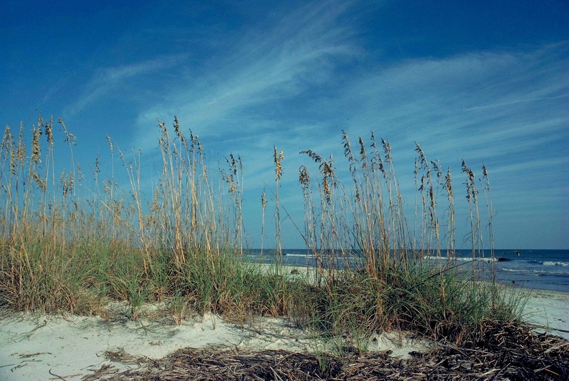
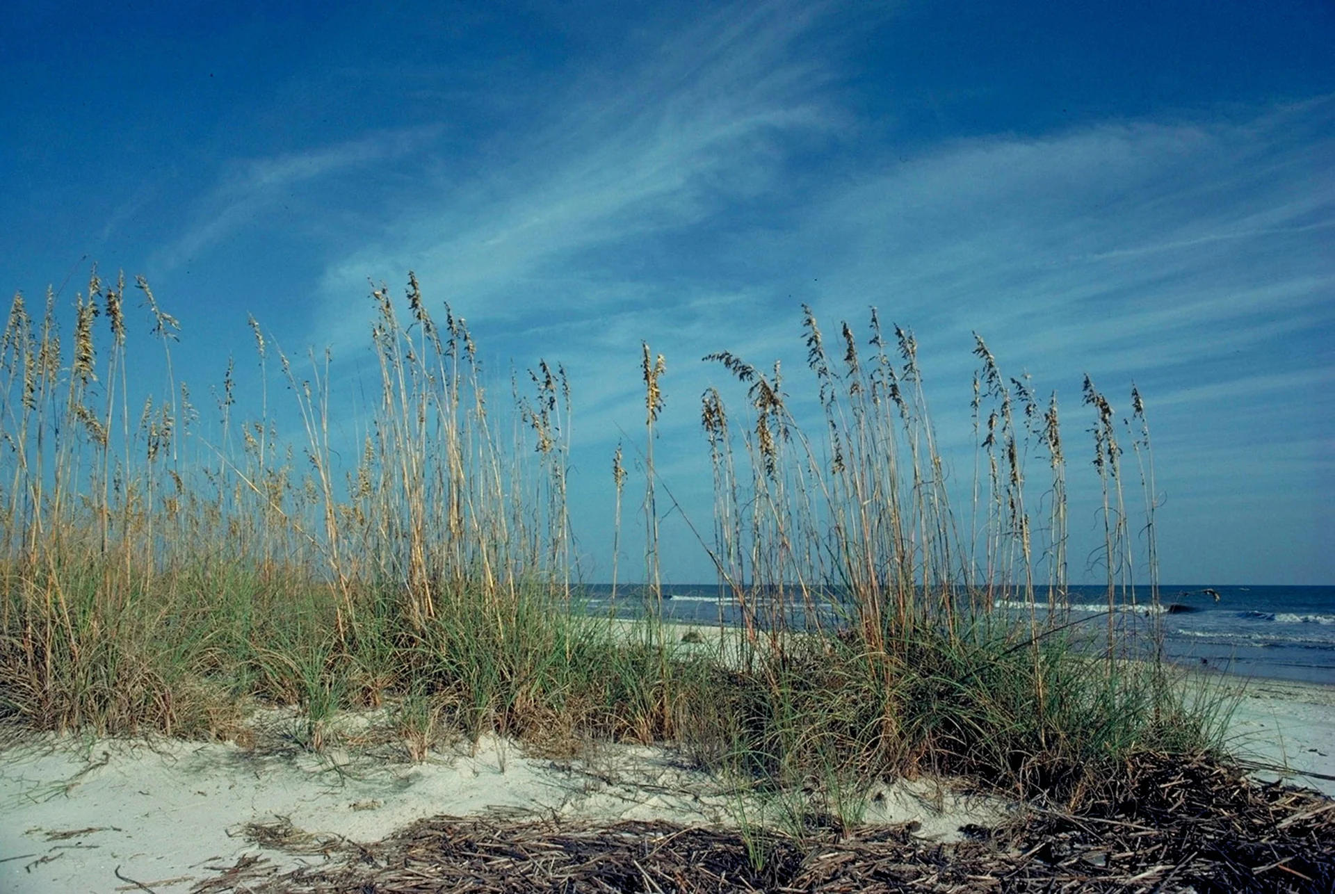
FWS identifies Atlantic beach habitat, maritime forest and marsh on Blackbeard. Posted habitat closures and changing tidal access govern the usable shore; island dimensions do not define a surveyed beach boundary.
Sources & review dates
sand shoreline
Source ↗ · Additional source ↗ · reviewed 2026-10-07
Surfing profile
No independently documented named surf break or activity suitability rating was found in the manager and local habitat sources. Atlantic surf existence is not a verified surfing recommendation.
Sources & review dates
surf
Source ↗ · Additional source ↗ · reviewed Date not recorded
Beachcombing
FWS protects natural resources and prohibits artifact collecting. An exact empty-shell collection permission/limit and beachcombing suitability rating need refuge confirmation.
No reliable notable shark-tooth association and collecting permission was established for this exact beach; it receives no shark-tooth tag or finding promise.
Sources & review dates
shelling
Source ↗ · reviewed Date not recorded
shark teeth
Source ↗ · Additional source ↗ · reviewed Date not recorded
Snorkeling & scuba diving
No independently documented named shore-snorkeling route or exact underwater-visibility assessment was established for Blackbeard Island Beach. Beach swimming/boat transport and regional reefs are separate activities; do not count this as a shore-snorkel match.
No current named McIntosh shore-scuba route or offshore scuba departure serving this beach was established. Gray’s Reef geography and general boating listings do not prove a bookable dive/snorkel excursion.
Sources & review dates
snorkeling
Source ↗ · Additional source ↗ · Additional source ↗ · reviewed Date not recorded
scuba
Source ↗ · Additional source ↗ · reviewed Date not recorded
Clothing-optional, nudity & topless sunbathing
Full nudity / clothing-optional: Permission not established.
Topless sunbathing: Permission not established.
No exact official designation, permission or separately verified prohibition established; no informal practice converted to permission. Researched separately; no exact current beach-specific permission/ruling established.
These are distinct policy questions. An unknown rule is not permission; Florida rules do not apply to Georgia.
Policy evidence & scope
Desk review 2026-10-07T20:52:08.196115+00:00.
Policy source ↗ · Blackbeard Island Beach: public_access_rules; exact scope stated in content, no adjacent-island or facility inheritance. · Retrieved 2026-10-07T20:44:07.177Z
Policy source ↗ · Blackbeard Island Beach: public_access_rules; exact scope stated in content, no adjacent-island or facility inheritance. · Retrieved 2026-10-07T20:44:07.193Z
Water clarity & shore snorkeling
Typical clarity: Not yet assessed. No exact underwater-visibility assessment established; sediment/water color, bacteria results and regional reef descriptions are distinct.
Shore snorkeling not yet assessed. No independently documented named shore-snorkeling route or exact underwater-visibility assessment was established for Blackbeard Island Beach. Beach swimming/boat transport and regional reefs are separate activities; do not count this as a shore-snorkel match.
Typical clarity describes how easily you may see through the water. It does not establish bacterial water quality, safe swimming, calm conditions or visibility today.
Evidence, location scope & review
Desk review 2026-10-07 · Atlantic beach parent, no entrance visibility rating. This is not an on-site inspection or a current conditions report.
No documented shore snorkeling route
Find clear-water and shore-snorkeling options ↗ · Report a change ↗
Shore & sky wildlife
FWS describes marsh winter waterfowl, forest migrant songbirds and refuge shorebirds; Blackbeard protects sea-turtle nesting and year-round bird habitat. Keep out of posted nesting closures and do not feed or disturb wildlife.
Sources & review dates
wildlife
Source ↗ · Additional source ↗ · Additional source ↗ · reviewed 2026-10-07
History & interesting facts
Blackbeard is part of the Savannah Coastal Refuges Complex and a federally managed coastal sanctuary. Protected natural and archaeological resources must remain in place; pirate lore is not verified treasure or collecting permission.
Sources & review dates
history
Source ↗ · Additional source ↗ · reviewed 2026-10-07
- Sand & shoreline
- Sand & shoreline
FWS identifies Atlantic beach habitat, maritime forest and marsh on Blackbeard. Posted habitat closures and changing tidal access govern the usable shore; island dimensions do not define a surveyed beach boundary.
Blackbeard Island Beach · sand shoreline ↗ - Surfing
- Surf · no suitability assumed
No independently documented named surf break or activity suitability rating was found in the manager and local habitat sources. Atlantic surf existence is not a verified surfing recommendation.
- Water
- Dated samples · not live safety
No current bacteria sample/advisory matched to Blackbeard Island Beach is asserted. Georgia Healthy Beaches is the responsible program; its published routine weekly roster names Jekyll, St. Simons and Tybee, not an exact sample for this route. Ask for the applicable historical segment/station and current monitoring scope; adjacent-island values are not substituted.
A closer look
Photos of this beach and its surroundings. Select a photo to view it larger. These are recorded views, not live conditions.
 View larger ↗
Sea oats rise above the sandy dunes beside the Atlantic shore of Blackbeard Island
Date: Capture date unknownBlackbeard Island coast · John Robinette / USFWS · Public Domain
Resized/cropped for display; original colors retained. Adaptations retain the stated license.
Food, stays & rentals
EXTEND YOUR BEACH DAY
Food & drink nearby
Local dining recommendations
Food & drink
Skipper's Fish Camp
Seafood restaurant on the Darien waterfront; plan mainland meals separately from island beach visits.
Visit Skipper's Fish Camp website ↗Website & source check
Website checked ↗ · checked 2026-10-07. Seafood restaurant on the Darien waterfront; plan mainland meals separately from island beach visits.
Research notes & location scope
No current on-beach dining or bar operation was established. Mainland Darien/McIntosh restaurants and bars are separately linked planning options before/after the boat trip; they are not refuge facilities.
Supporting research source ↗ · reviewed Date not recorded
These listings are unpaid and contain no affiliate links.
Accommodations by the beach
Accommodation
Darien Dockside Inn
Darien lodging base at 201 Broad Street; arrange island transport separately.
Visit Darien Dockside Inn website ↗Website & source check
Website checked ↗ · checked 2026-10-07. Darien lodging base at 201 Broad Street; arrange island transport separately.
Before you book
Confirm the exact property or rental unit, view category, beach route, accessibility and total price directly. Nearby lodging does not establish access to a private beach, a boat transfer or permission to camp.
Research notes & location scope
Recreational overnight beach stays and camping are prohibited by current FWS visitor rules. Mainland Darien/McIntosh lodging is separate from island facilities or a guaranteed boat transfer.
Supporting research source ↗ · Supporting research source ↗ · reviewed 2026-10-07
These listings are unpaid and contain no affiliate links.
Activities & rentals
No current exact beach rental or snorkeling/scuba departure was established. Boat transport to a refuge does not establish a snorkeling excursion; confirm permitted landing and activity with the manager.
Arrange transport and confirm the exact beach stop directly. No affiliate relationship or snorkeling/scuba availability is inferred.
Explore nearby beaches
Sources & review date
Guide desk research reviewed 2026-10-07; this is not a field-by-field current verification or an on-site inspection. Official facts, dated agency evidence and editorial assessments retain their own scope. Unknowns and conflicts remain open. Methodology · Rating explanations · Correction history
- Blackbeard Island Beach · identity location ↗
- Blackbeard Island Beach · summary description ↗
- Blackbeard Island Beach · known for ↗
- Blackbeard Island Beach · surf rip forecast ↗
- Blackbeard Island Beach · public access ↗
- Blackbeard Island Beach · sand shoreline ↗
- Blackbeard Island Beach · wildlife ↗
- Blackbeard Island Beach · accommodations ↗
- Blackbeard Island Beach · fire rules ↗
- Blackbeard Island Beach · camping rules ↗
- Blackbeard Island Beach · shore fishing rules ↗
- Blackbeard Island Beach · hours ↗
- Blackbeard Island Beach · dogs ↗
- Blackbeard Island Beach · history ↗
- Blackbeard Island Beach · managing authority ↗
- Blackbeard Island Beach · official source links ↗
- Blackbeard Island Beach · main photo ↗
- Blackbeard Island Beach · photo gallery ↗
- Blackbeard Island Beach · plan your visit ↗
- Blackbeard Island Beach · check before you go ↗
- Blackbeard Island Beach · nearby beaches ↗
- Blackbeard Island Beach · closer look ↗
Photo: Blackbeard Island coast by John Robinette / USFWS · Public Domain. Cropped for display; adaptations retain this license.
Visitor experiences
Original, moderated reviews and photographs. Visit dates and entrances provide context; visitor ratings and reports do not replace official facts or current conditions.
Read approved visitor experiences here when available.