
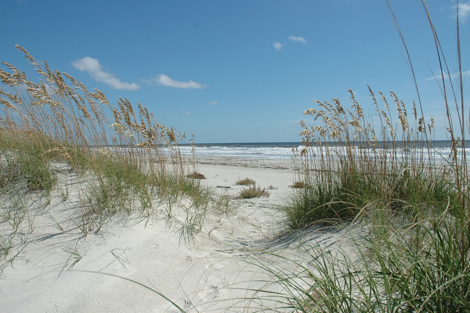
Coastal Georgia · Georgia
Cumberland Island Beach
- State
- Georgia
- County
- Camden County
- City / community
- Cumberland Island
Coastal Georgia
Reach this undeveloped Atlantic island by passenger ferry or private boat, then walk from the Sound-side dock across maritime forest and dunes to the ocean beach. Sea Camp is the practical first beach route for ferry day visitors.
Good fit: Reach this undeveloped Atlantic island by passenger ferry or private boat, then walk from the Sound-side dock across maritime forest and dunes to the ocean beach. Sea Camp is the practical first beach route for ferry day visitors.
Plan around: See the entrance section for accessibility details and sources.
PLAN THE BASICS
At a glance
- Parking
- Parking & entry · see routeDetails & restrictions
- Dogs
- Unknown · clarification pendingDetails & restrictions
- Restrooms
- YesDetails & restrictions
- Lifeguards
- NoDetails & restrictions
- Public access
- Public accessDetails & restrictions
- Beach driving
- NoDetails & restrictions
- Accessibility
- Access route · see limitsDetails & restrictions
Choose an entrance
Sea Camp Dock to Sea Camp Beach Crossing
Passenger ferry/private boat to Sea Camp Dock; walk the designated half-mile trail and dune boardwalk to the ocean, with soft sand before beach. Authority listing is not a same-day opening report. Destination reference is historical ocean beach monitoring point; dock coordinate is30.764333,-81.470629 from named NPS event.
Official route / restriction details ↗Dungeness Dock and Dungeness Beach Crossing
Designated south-end paths and marsh boardwalk/dune crossing; NPS discourages exposed dune route in summer heat and recommends SeaCamp. Authority listing is not a same-day opening report.
Official route / restriction details ↗Stafford Beach route
Stafford campground is3.5milesnorthofSeaCampDock; follow designated mapped crossing, carrygear, campgroundreservationrequiredforovernightstay. Authority listing is not a same-day opening report.
Official route / restriction details ↗Parking, route & accessibility evidence
Parking & entry: Parking & entry · see route. Leave the car on the mainland: there is no public road connection and the ferry is passenger-only. NPS describes visitor parking and overnight parking for island overnight visitors. A parking fee, space count and current ADA-space inventory were not established. Park entrance and ferry charges remain separate.
Accessibility: Access route · see limits. Sea Camp uses a 0.5-mile sandy trail, dune boardwalk and soft-sand gap; it is not a continuous paved route to the water. Free beach mobility equipment is documented at Sea Camp/Dungeness; reserve motorized trackchairs at least two weeks ahead. NPS pages disagree on beach-chair count, so availability should be confirmed.
Accessibility source ↗Open the county entrance directory ↗
Use the directory to check each entrance’s identity and status. Guide map pins are approximate shoreline locations, not turn-by-turn entrance directions or proof of current opening.
Known for
Undeveloped beach, beachcombing and wildlife viewing, with historic Dungeness reached by a separate south-end walk. The horses are feral wildlife; keep at least 50 feet away and do not feed, pet or ride them.
Sources & review dates
known for
Source ↗ · Additional source ↗ · reviewed 2026-10-07
Rules & facilities
Check before you go
Check current NPS restrictions, ferry booking/schedule, hunts, crossing maintenance and mobility equipment. The chair count and beach-fire rule conflicts remain isolated clarification tasks; no broad current-open or safety claim is made.
Sources & review dates
check before you go
Source ↗ · Additional source ↗ · Additional source ↗ · Additional source ↗ · Additional source ↗ · reviewed 2026-10-07
Admission, payment & passes
NPS entrance is $15 per adult age16+ for seven days; age15and younger free. Eligible federal passes waive the entry fee under their terms. Cashless entry. Ferry and camping are separately charged; the public ferry currently advertises adult$44/senior$42/youth$34 plus applicable taxes.
Sources & review dates
admission payment passes
Source ↗ · Additional source ↗ · Additional source ↗ · reviewed 2026-10-07
What to bring & supporting visit details
Plan your visit
Reserve round-trip transport, check in at113StMarysStreet an hour before departure, bring food/water/insect protection and allow time for the sandy half-mile route to Sea Camp. Match camping dates to ferry availability.
Sources & review dates
plan your visit
Source ↗ · Additional source ↗ · Additional source ↗ · reviewed 2026-10-07
Public or private?
Public access
Who can visit: Visitors using the named public route, subject to posted and managing-authority restrictions.
Entry route, fees & access boundaries
- Manager / access authority
- National Park Service manages Cumberland Island National Seashore; Georgia coastal rules and private/retained-rights ownership must retain their exact scope. Proposed 2026 land exchange is not a completed access-rights change.
- Access basis
- Use the passenger ferry from St. Marys or a private boat. Sea Camp, Dungeness and Plum Orchard docks have distinct day-use landing rules. Follow signed established roads/trails to designated dune crossings; private and retained-rights parcels do not become unrestricted public routes.
- Where to enter
- Use the passenger ferry from St. Marys or a private boat. Sea Camp, Dungeness and Plum Orchard docks have distinct day-use landing rules. Follow signed established roads/trails to designated dune crossings; private and retained-rights parcels do not become unrestricted public routes.
- Fees & reservations
- See the entrance section for parking and entry details and sources.
- Restrictions & exceptions
- Stay on marked roads/trails and dune crossings, obey private-property and nesting closures, and do not land in marsh grass. Private-boat dock rules do not grant access to private island docks or every shoreline.
- What this label covers
- Named public arrival only; no surveyed boundary or adjacent private crossing inferred.
Beach ownership, the route across land, public shoreline-use rights and access to facilities are separate questions. Rules vary by state and location. Use the identified public entrance or documented permission; neither a nearby resort nor an admission fee by itself establishes that a beach is private. A mapped beach is not permission to cross private property.
Access policy reviewed 2026-10-07. Not a live closure report or a property-boundary survey.
Allowed & prohibited activities
Alcohol: Alcohol rules are not confirmed for this beach.
What still needs confirmation
An exact public ocean-beach alcohol rule was not established. Private inn dining or a mainland saloon does not establish permission to drink on the beach.
Fires and grills: Published guidance conflicts; confirm the applicable rule before your visit.
What still needs confirmation
Official sources conflict: the June 2026 compendium describes conditional beach fires below high tide, while the Sea Camp campground page says no beach fires. Confirm with a ranger before planning a fire. Designated campground fire rings and posted high-fire-danger restrictions remain separate.
Overnight camping: Camping is allowed only in five designated campgrounds with a reservation/permit, for up to seven consecutive nights. No dispersed beach camping. Sea Camp individual sites are $22/night, Stafford $12/night and wilderness $9/permit/night; entrance and ferry charges are separate. Confirm hunts/closures when booking.
Shore fishing: Fishing is allowed subject to Georgia licensing/rules. Dock fishing at Sea Camp, Plum Orchard and Dungeness must not interfere with public safety or boat movements. Ocean fishing is not a promise of swimming suitability.
Sources & review dates
Alcohol
Source ↗ · Additional source ↗ · reviewed Date not recorded
Fires and grills
Source ↗ · Additional source ↗ · reviewed Date not recorded
Overnight camping
Source ↗ · Additional source ↗ · reviewed 2026-10-07
Shore fishing
Source ↗ · Additional source ↗ · reviewed 2026-10-07
- Hours
- Hours · see named route
Beach access is governed by transport, permits and closures rather than the visitor-center clock. The current October-November ferry schedule departs St. Marys 9AM/11:45AM and the island 10:15AM/4:45PM Eastern; arrive an hour before departure. Private docking is sunrise-sunset with no overnight docking. Verify booking-day schedules.
Cumberland Island Beach · hours ↗ - Dogs on the beach
- Dog rule · see details
Pets require private-boat transport, a leash/control and a day-only visit; no ferry pets, campgrounds or designated wilderness. NPS describes southern roads/trails but the exact ocean-sand footprint was not expressly resolved in the reviewed visitor page. Service animals are separate.
- Lifeguards
- No lifeguards
No lifeguards on the island. Swimming is permitted at the visitor's risk; check currents and restrictions before entering.
Cumberland Island Beach · lifeguards ↗ - Restrooms
- Restrooms · see entrance
Sea Camp bathhouse is immediately before the dune crossing and has restrooms, drinking water and cold showers. It is a campground/crossing facility, not a toilet on the open beach. Dungeness and other mapped facilities have their own locations. Current repair exceptions require confirmation.
Cumberland Island Beach · restrooms showers ↗ - Access & beach rules
- Named manager rules
Stay on marked roads/trails and dune crossings, obey private-property and nesting closures, and do not land in marsh grass. Private-boat dock rules do not grant access to private island docks or every shoreline.
Cumberland Island Beach · public access rules ↗ - Beach driving
- No beach driving
General-public motor-vehicle operation is prohibited on park lands. State beach-driving permits/retained property rights are restricted exceptions, not public drive-on access. Ferry passengers cannot bring cars.
Cumberland Island Beach · driving ↗
Conditions & activities Surf, sand, wildlife and suitability
Conditions at the beach
Official source links and saved records may be out of date. Local times use Eastern Time. Forecasts, observations, tide predictions, laboratory samples and retrieval dates are separate; no current swimming-safety status is implied.
Weather, forecasts & tides
Current entrance-specific weather observations were not established in this research packet. Use a dated NWS forecast for the Sea Camp ocean point; a forecast is not an observed beach flag.
Plan for heat, sun, biting insects and changing coastal weather. A dated NWS point forecast should be labeled forecast, with its issue and retrieval clocks.
NOAA Sea Camp Dock station 8679758 provides tide predictions for the island’s west-side Cumberland Sound dock. Use it for regional landing planning; its timing is not verified as the Atlantic Sea Camp Beach tide clock. Predictions are not observed beach conditions.
The open-ocean beach can develop rip currents. NPS directs visitors to check the surf forecast or ask a ranger that day. No surf-suitability score or observed flag is inferred.
Sources & review dates
live weather
Source ↗ · reviewed Date not recorded
daily forecast
Source ↗ · Additional source ↗ · reviewed Date not recorded
tides
Source ↗ · reviewed 2026-10-07
surf rip forecast
Source ↗ · reviewed 2026-10-07
Flags, closures & water quality
Check NPS Alerts & Conditions and signs before crossing dunes or entering posted areas. Managed hunts and protected nesting areas can create scoped closures; no observed beach flag or universal current-open assertion was verified.
No current Cumberland ocean-beach bacteria sample or advisory was verified. The Georgia Healthy Beaches map mainly presents Tybee, St. Simons and Jekyll monitoring; the Sea Camp USGS station has a historical 1999 record only. That record cannot indicate today's water quality.
Sources & review dates
official flags closures
Source ↗ · Additional source ↗ · Additional source ↗ · reviewed Date not recorded
water quality
Source ↗ · Additional source ↗ · reviewed Date not recorded
Crowd meter
Sea Camp is the closest ocean crossing to the ferry dock. NPS says Sea Camp camping often fills; no observed peak beach-crowd classification is established. Reserve transport/camping and leave time to return.
Sources & review dates
crowds
Source ↗ · Additional source ↗ · reviewed Date not recorded
Sand & sandcastles
The route passes maritime forest and a dune boardwalk, followed by shifting soft sand at Sea Camp. Use designated crossings and avoid the dunes. Dungeness has a separate exposed dune crossing that NPS advises avoiding during summer heat.
Sources & review dates
sand shoreline
Source ↗ · Additional source ↗ · reviewed 2026-10-07
Surfing profile
No beach-specific surf break, season or suitability rating was verified. Open-ocean waves and swimming permission do not establish a surfing recommendation.
Sources & review dates
surf
Source ↗ · reviewed Date not recorded
Beachcombing
Unoccupied shells may be collected for noncommercial purposes, up to two gallons per person per day under the current compendium. Leave live shells and other protected natural or historic objects.
Fossilized shark teeth may be collected for noncommercial purposes. NPS says teeth are more commonly found in dredge spoils used on park roads/dock areas than on the beach; this is not a guarantee or an invitation off designated routes.
Sources & review dates
shelling
Source ↗ · Additional source ↗ · reviewed 2026-10-07
shark teeth
Source ↗ · Additional source ↗ · reviewed 2026-10-07
Snorkeling & scuba diving
A documented shore snorkeling route and typical underwater visibility at Sea Camp have not been established. The 2022 estuarine ecological clarity assessment is not an ocean-beach visibility rating. No verified local offshore snorkeling excursion was found in the operator/tourism search.
Wreckreation Scuba is a mainland St. Marys training shop. A currently operating Cumberland shore-diving route or offshore dive/snorkeling excursion was not verified. Fish Master is listed by official city tourism as a fishing charter; diving availability and actual departure remain unverified.
Sources & review dates
snorkeling
Source ↗ · Additional source ↗ · Additional source ↗ · Additional source ↗ · reviewed Date not recorded
scuba
Source ↗ · Additional source ↗ · reviewed Date not recorded
Clothing-optional, nudity & topless sunbathing
Full nudity / clothing-optional: Permission not established.
Topless sunbathing: Permission not established.
No exact official designated area or separate current applicable prohibition resolved. Absence from compendium is not permission. Keep independently unresolved; nudity or adult-entertainment definitions do not automatically establish topless policy.
These are distinct policy questions. An unknown rule is not permission; Florida rules do not apply to Georgia.
Policy evidence & scope
Desk review 2026-10-07T19:18:46.922010+00:00.
Policy source ↗ · Cumberland Island / exact field scope stated in content; not every private parcel or current operating condition. · Retrieved 2026-10-07T19:14:03.209Z
Policy source ↗ · Cumberland Island / exact field scope stated in content; not every private parcel or current operating condition. · Retrieved 2026-10-07T19:14:03.257Z
Water clarity & shore snorkeling
Typical clarity: Not yet assessed. 2022 estuarine ecological light-attenuation assessment cannot establish Atlantic shore visibility. No clear-water matcher boost.
Shore snorkeling not yet assessed. No documented legal shore snorkeling route found; unknown does not mean prohibited.
Typical clarity describes how easily you may see through the water. It does not establish bacterial water quality, safe swimming, calm conditions or visibility today.
Evidence, location scope & review
Desk review 2026-10-07 · Atlantic beach parent, no entrance visibility rating. This is not an on-site inspection or a current conditions report.
No documented shore snorkeling route
Find clear-water and shore-snorkeling options ↗ · Report a change ↗
Shore & sky wildlife
Feral horses, shorebirds and nesting sea turtles are documented locally. Keep at least 50 feet from horses; never feed wildlife; stay outside posted bird/turtle nesting closures. The horses are unmanaged wildlife, not visitor rides.
Sources & review dates
wildlife
Source ↗ · Additional source ↗ · reviewed 2026-10-07
History & interesting facts
The Dungeness historic district and interpretive island sites are a separate walk from the ocean. Respect closed historic structures and do not collect artifacts. NPS history resources explain the island's layered cultural history; ruins are not a beach amenity or a currently open building.
Sources & review dates
history
Source ↗ · Additional source ↗ · Additional source ↗ · reviewed 2026-10-07
- Sand & shoreline
- Sand & shoreline
The route passes maritime forest and a dune boardwalk, followed by shifting soft sand at Sea Camp. Use designated crossings and avoid the dunes. Dungeness has a separate exposed dune crossing that NPS advises avoiding during summer heat.
Cumberland Island Beach · sand shoreline ↗ - Surfing
- Surf · no suitability assumed
No beach-specific surf break, season or suitability rating was verified. Open-ocean waves and swimming permission do not establish a surfing recommendation.
- Water
- Dated samples · not live safety
No current Cumberland ocean-beach bacteria sample or advisory was verified. The Georgia Healthy Beaches map mainly presents Tybee, St. Simons and Jekyll monitoring; the Sea Camp USGS station has a historical 1999 record only. That record cannot indicate today's water quality.
A closer look
Photos of this beach and its surroundings. Select a photo to view it larger. These are recorded views, not live conditions.
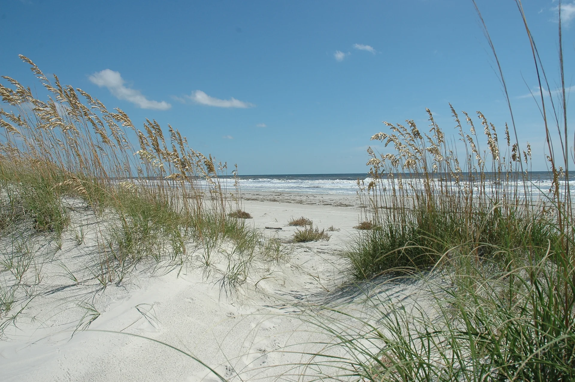 View larger ↗
Sea oats frame the sand and Atlantic surf on Cumberland Island
Taken: 2008-09-04Beach · Cumberland Island National Seashore / NPS · CC BY-SA 2.0
Resized/cropped for display; original colors retained. Adaptations retain the stated license.
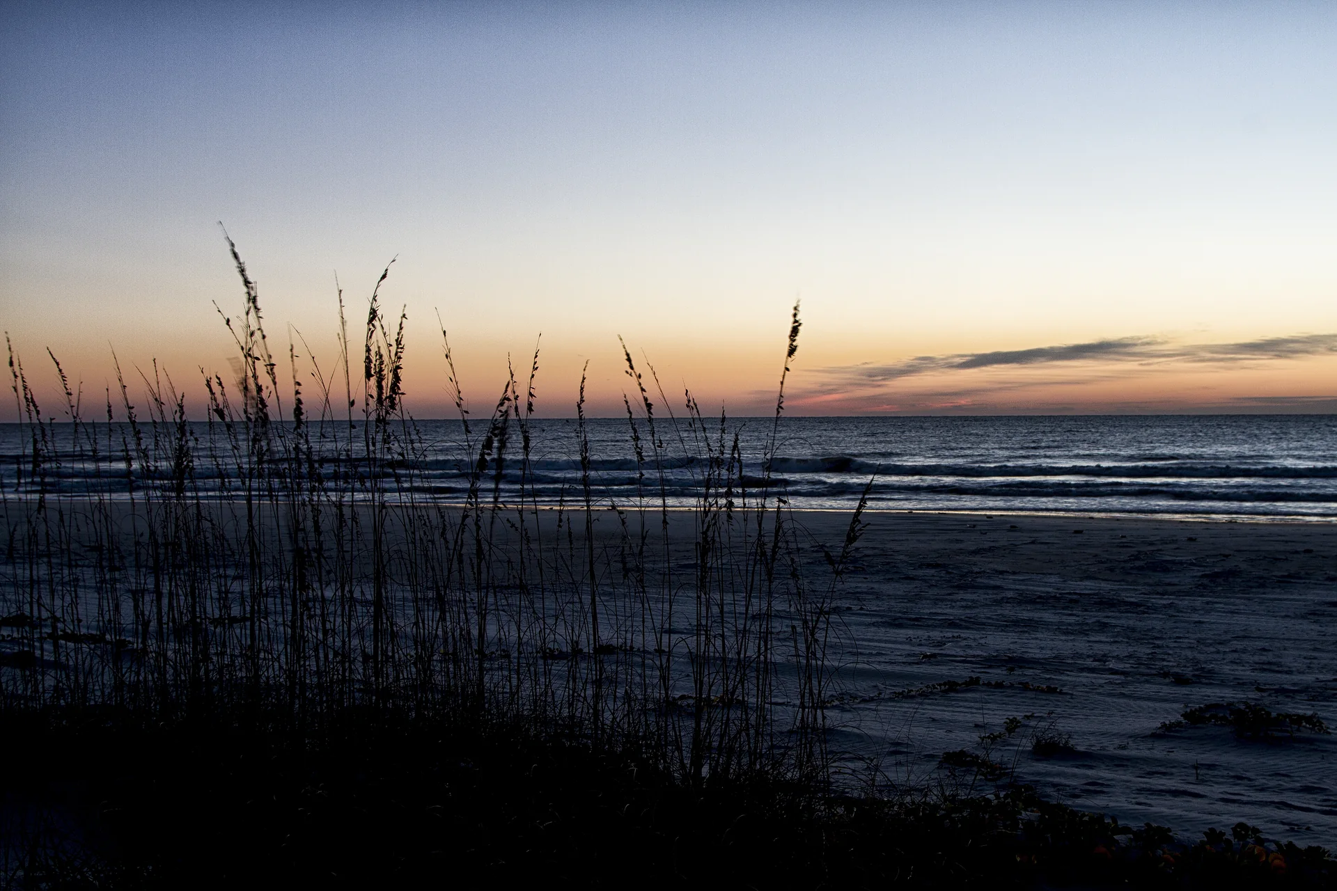 View larger ↗
Dune grasses silhouetted beside Cumberland Island’s Atlantic beach at sunrise
Capture date not confirmedUndeveloped Coast · NPS Photo; individual photographer not named · Public domain — original U.S. Government work
Resized/cropped for display; original colors retained. Adaptations retain the stated license.
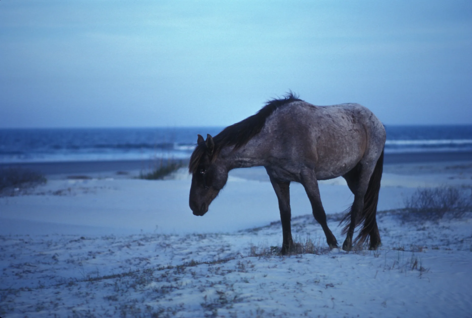 View larger ↗
A feral horse on the beach at Cumberland Island in an archival 2005 photograph
Taken: 2005-06-16Horse on Cumberland Island beach · George Gentry / USFWS · Public Domain
Resized/cropped for display; original colors retained. Adaptations retain the stated license.
Food, stays & rentals
EXTEND YOUR BEACH DAY
Food & drink nearby
Local dining recommendations
Pack lunch for the public island visit. Linked restaurant/bar options are on the mainland. Greyfield private meals are lodging guest services.
Food & drink
Locals Dockside
307 West St. Marys Street, mainland pre/post-ferry dining; not beach food.
Visit Locals Dockside website ↗Website & source check
Website checked ↗ · Supporting source 2 ↗ · checked 2026-10-07. 307 West St. Marys Street, mainland pre/post-ferry dining; not beach food.
Food & drink
Captain Seagle’s Restaurant
105 Osborne Street mainland restaurant; verify hours directly.
Visit Captain Seagle’s Restaurant website ↗Website & source check
Website checked ↗ · Supporting source 2 ↗ · checked 2026-10-07. 105 Osborne Street mainland restaurant; verify hours directly.
Research notes & location scope
Pack food for a public park day: no public restaurants or shops are provided. Before/after the ferry, mainland Locals Dockside and Captain Seagle's offer dining; Captain Seagle's Saloon and Brackish Beer Company are separately linked bar/brewery options. Greyfield meals are private guest lodging services.
Supporting research source ↗ · Supporting research source ↗ · Supporting research source ↗ · Supporting research source ↗ · Supporting research source ↗ · reviewed 2026-10-07
These listings are unpaid and contain no affiliate links.
Accommodations by the beach
Separate mainland stays, permitted public camping and private on-island inn.
Accommodation
Goodbread House
209 Osborne Street mainland inn, separate trip to ferry.
Visit Goodbread House website ↗Website & source check
Supporting source ↗ · checked 2026-10-07. 209 Osborne Street mainland inn, separate trip to ferry.
Accommodation
Spencer House Inn
200 Osborne Street mainland inn; no beach facilities inherited.
Visit Spencer House Inn website ↗Website & source check
Supporting source ↗ · checked 2026-10-07. 200 Osborne Street mainland inn; no beach facilities inherited.
Accommodation
Riverview Hotel
105 Osborne Street mainland waterfront hotel.
Visit Riverview Hotel website ↗Website & source check
Supporting source ↗ · checked 2026-10-07. 105 Osborne Street mainland waterfront hotel.
Accommodation
Greyfield Inn
Private on-island guest lodging, meals and equipment; private ferry from Fernandina Beach Florida; not public NPS day amenities.
Visit Greyfield Inn website ↗Website & source check
Website checked ↗ · Supporting source 2 ↗ · checked 2026-10-07. Private on-island guest lodging, meals and equipment; private ferry from Fernandina Beach Florida; not public NPS day amenities.
Accommodation
Cumberland Island designated camping
Reserved designated tent camping, distinct from dispersed beach camping.
Visit Cumberland Island designated camping website ↗Website & source check
Website checked ↗ · checked 2026-10-07. Reserved designated tent camping, distinct from dispersed beach camping.
Before you book
Confirm the exact property or rental unit, view category, beach route, accessibility and total price directly. Nearby lodging does not establish access to a private beach, a boat transfer or permission to camp.
Research notes & location scope
Public tent camping requires reservations and a permit at designated Sea Camp, Stafford and three wilderness campgrounds. Greyfield Inn is separate private island lodging with its own Fernandina Beach ferry and guest services. Mainland Goodbread House, Spencer House Inn and Riverview Hotel are pre/post-ferry stays, not beach facilities.
Supporting research source ↗ · Supporting research source ↗ · Supporting research source ↗ · Supporting research source ↗ · reviewed 2026-10-07
These listings are unpaid and contain no affiliate links.
Activities & rentals
Regional dive businesses retained as researched operator references, not certified snorkeling tours or on-beach rentals.
Cumberland Island Ferry
Book passenger ferry separately; exact departure schedule subject to confirmation.
Visit Cumberland Island Ferry website ↗Source and scope check
Operator source ↗ · checked 2026-10-07T19:18:46.922010+00:00. St. Marys mainland passenger ferry; booking and schedule separate from park entrance. No public motor vehicle or pet carriage except qualifying service animals.
Direct operator links; no affiliate arrangement is established. Boat excursions do not establish shore snorkeling or a public launch.
Sources & review date
Guide desk research reviewed 2026-10-07; this is not a field-by-field current verification or an on-site inspection. Official facts, dated agency evidence and editorial assessments retain their own scope. Unknowns and conflicts remain open. Methodology · Rating explanations · Correction history
- Cumberland Island Beach · identity location ↗
- Cumberland Island Beach · summary description ↗
- Cumberland Island Beach · known for ↗
- Cumberland Island Beach · tides ↗
- Cumberland Island Beach · surf rip forecast ↗
- Cumberland Island Beach · public access ↗
- Cumberland Island Beach · sand shoreline ↗
- Cumberland Island Beach · shelling ↗
- Cumberland Island Beach · shark teeth ↗
- Cumberland Island Beach · wildlife ↗
- Cumberland Island Beach · accommodations ↗
- Cumberland Island Beach · commercial activities rentals ↗
- Cumberland Island Beach · camping rules ↗
- Cumberland Island Beach · shore fishing rules ↗
- Cumberland Island Beach · hours ↗
- Cumberland Island Beach · lifeguards ↗
- Cumberland Island Beach · restrooms showers ↗
- Cumberland Island Beach · accessibility ↗
- Cumberland Island Beach · driving ↗
- Cumberland Island Beach · public access rules ↗
- Cumberland Island Beach · dining ↗
- Cumberland Island Beach · history ↗
- Cumberland Island Beach · managing authority ↗
- Cumberland Island Beach · official source links ↗
- Cumberland Island Beach · main photo ↗
- Cumberland Island Beach · photo gallery ↗
- Cumberland Island Beach · admission payment passes ↗
- Cumberland Island Beach · plan your visit ↗
- Cumberland Island Beach · check before you go ↗
- Cumberland Island Beach · closer look ↗
Photo: Beach by Cumberland Island National Seashore / NPS · CC BY-SA 2.0. Cropped for display; adaptations retain this license.
Visitor experiences
Original, moderated reviews and photographs. Visit dates and entrances provide context; visitor ratings and reports do not replace official facts or current conditions.
Read approved visitor experiences here when available.