
Franklin County Gulf Coast · Florida
Bald Point State Park Beach
- State
- Florida
- County
- Franklin County
- City / community
- Alligator Point
Florida Panhandle · Franklin County Gulf Coast
A state-park coastal beach setting where marshes, bay water and sandy shore meet, with picnic facilities and reported mobility mats at beach accesses.
Good fit: A state-park coastal beach setting where marshes, bay water and sandy shore meet, with picnic facilities and reported mobility mats at beach accesses.
Plan around: Exact unconfirmed fixtures and staffing remain scoped; check the named arrival before travel.
- Parking
- See arrival details
- Dogs
- No
Details & sources
Pets are not permitted on state-park beach sand. Leashed trail/campsite or picnic-area permission does not extend to beaches.
Bald Point State Park Beach · dogs evidence ↗ - Restrooms
- Yes
Details & sources
The park lists nearby restrooms at its three beach access areas and specifically identifies outdoor showers at Sunrise Beach. Confirm the working fixture at your chosen entrance; this does not establish shower availability at North End or Maritime Hammock today.
Bald Point State Park Beach · restrooms showers · scoped official evidence ↗ - Lifeguards
- No
Details & sources
Lifeguards are not provided at the state-park beaches. Warning signs, mobility equipment and picnic facilities do not constitute staffed swimming supervision.
Bald Point State Park Beach · lifeguards evidence ↗ - Key restrictions
- Check before you go
Details & sources
Use public signed crossings, control dogs where allowed, respect dunes and remove beach equipment rather than leaving it overnight. State-park and refuge restrictions take priority over county marketing.
Bald Point State Park Beach · public access rules evidence ↗ - Best for
- See beach overview
Beach overview
A state-park coastal beach setting where marshes, bay water and sandy shore meet, with picnic facilities and reported mobility mats at beach accesses.
Sources & review dates
More planning facts: access, driving & fees
- Public access
- Public accessDetails & restrictions
- Beach driving
- NoDetails & restrictions
Choose an entrance
Named North Point/Sunrise/Maritime Hammock beach-use routes
State-park named Apalachee Bay beach-use routes. Adjacent Bald Point street observations are not automatically park memberships.
Official route / restriction details ↗Parking, route & accessibility evidence
Parking & entry: Official park page lists $4 per vehicle up to eight people or $2 pedestrian/bicycle. Use the signed beach-use parking; historic street crossings are separate.
Parking source ↗Accessibility: State Parks names mobi-mat access at Sunrise and North End, accessible showers/pavilions and a beach wheelchair by park-office reservation. Mats may end before the water; no continuous parking-to-water or stair-free route is inferred.
Accessibility source ↗Open the county entrance directory ↗
Use the directory to check each entrance’s identity and status. Guide map pins are approximate shoreline locations, not turn-by-turn entrance directions or proof of current opening.
Known for
Coastal marshes, shorebirds, migrating raptors and sandy bay beach routes.
Sources & review dates
known for
Source ↗ · Additional source ↗ · reviewed 2026-10-05
Exact unconfirmed fixtures and staffing remain scoped; check the named arrival before travel.
Rules & facilities
Check before you go
Check current state-park alerts and the chosen route’s fixtures or special-use access, rather than transferring amenities between areas.
Sources & review dates
check before you go
Source ↗ · Additional source ↗ · reviewed 2026-10-05
Admission, payment & passes
Current official park page lists $4 per vehicle, up to eight people, or $2 pedestrian/bicycle.
Sources & review dates
admission payment passes
Source ↗ · reviewed 2026-10-05
What to bring & supporting visit details
Plan your visit
Choose the named public arrival and check current water notices, dog rules, route fixtures and parking. A picnic shelter is park shade rather than shade along the whole shore.
Sources & review dates
plan your visit
Source ↗ · reviewed 2026-10-05
Public or private?
Public access
Who can visit: Open to the general public, including visitors, during permitted hours and subject to posted rules.
Entry route, fees & access boundaries
- Manager / access authority
- Florida Department of Environmental Protection, Division of Recreation and Parks, manages this state-park shoreline.
- Access basis
- This listing covers a publicly managed beach access or park, not a private guest-only beach.
- Where to enter
- The authority identifies this named public shoreline. Use lawful signed crossings; narrow identity does not grant access through private parcels or draw the outer sand boundary.
- Fees & reservations
- Current official park page lists $4 per vehicle, up to eight people, or $2 pedestrian/bicycle.
- Restrictions & exceptions
- Use public signed crossings, control dogs where allowed, respect dunes and remove beach equipment rather than leaving it overnight. State-park and refuge restrictions take priority over county marketing.
- What this label covers
- Named shoreline and supported arrival only; public access is separate from temporary closure.
Beach ownership, the route across land, public shoreline-use rights and access to facilities are separate questions. Rules vary by state and location. Use the identified public entrance or documented permission; neither a nearby resort nor an admission fee by itself establishes that a beach is private. A mapped beach is not permission to cross private property.
Access policy reviewed 2026-10-05. Not a live closure report or a property-boundary survey.
Allowed & prohibited activities
Alcohol: Consumption of alcoholic beverages is prohibited in the state-park picnic/beach-use setting.
Fires and grills: Any permitted fire or grill areas still need confirmation. Follow the restrictions stated here.
What still needs confirmation
No exact open beach-fire permission was established. Picnic grills, where expressly listed, do not authorize a fire on the sand.
Overnight camping: The park lists one primitive campsite on Chaires Creek, reached by paddlecraft or boat and arranged through the park at 850-349-9146 or Ochlockonee River State Park at 850-962-2771. This separate creek campsite does not authorize sleeping at the North End, Sunrise or Maritime Hammock beach arrivals; confirm current availability before booking.
Shore fishing: The park identifies surf fishing at North End and Sunrise. A small fishing pier with Mobi-Mat access is at North End, where Bald Point Road terminates at Ochlockonee Bay. The source also describes oyster-bar wading, but that is not an accessible-water-entry or current-safety promise. Follow posted restrictions and Florida license, season, size and harvest rules.
- Hours
- State-park day use: 8 a.m. to sunset, year-round. Special-use fishing and booked camping require their own arrangement; no after-hours entitlement inferred.Bald Point State Park Beach · hours evidence ↗
- Dogs on the beach
- Pets are not permitted on state-park beach sand. Leashed trail/campsite or picnic-area permission does not extend to beaches.Bald Point State Park Beach · dogs evidence ↗
- Lifeguards
- Lifeguards are not provided at the state-park beaches. Warning signs, mobility equipment and picnic facilities do not constitute staffed swimming supervision.Bald Point State Park Beach · lifeguards evidence ↗
- Restrooms
- The park lists nearby restrooms at its three beach access areas and specifically identifies outdoor showers at Sunrise Beach. Confirm the working fixture at your chosen entrance; this does not establish shower availability at North End or Maritime Hammock today.Bald Point State Park Beach · restrooms showers · scoped official evidence ↗Field reviewed 2026-10-07
- Access & beach rules
- Use public signed crossings, control dogs where allowed, respect dunes and remove beach equipment rather than leaving it overnight. State-park and refuge restrictions take priority over county marketing.Bald Point State Park Beach · public access rules evidence ↗
- Beach driving
- Use lawful roads and signed parking. Do not drive onto sand or dunes from a public street crossing; special-use access permissions must be obtained separately.Bald Point State Park Beach · driving evidence ↗
Conditions & activities Surf, sand, wildlife and suitability
Conditions at the beach
Saved reports below are dated snapshots, not live conditions. JavaScript refreshes them from official sources when available. Source timestamps and tide times identify their time zone.
Weather observation
Saved report · not live. This dated snapshot may be out of date. Check the official source before your visit.
61°F · Cloudy
- Tallahassee International Airport · 50.7 km from destination reference · nearby reporting station, not a beach sensor.
Observation: 2026-11-20T10:40:00+00:00.
Retrieved: 2026-11-20T10:58:19.394Z.
Live-use expiration: 2026-11-20T12:40:00.000Z. This static copy never certifies current conditions.
UV forecast
No current-hour UV estimate is shown in this saved page. Use sun protection; the live forecast loads when available.
Daily forecast
Saved report · not live. This dated snapshot may be out of date. Check the official source before your visit.
Saved forecast for this beach’s NWS grid
- 2026-11-20T05:00:00-05:00–2026-11-20T06:00:00-05:00: Overnight · 64°F · Chance Rain Showers · wind 20 mph NE
- 2026-11-20T06:00:00-05:00–2026-11-20T18:00:00-05:00: Friday · 70°F · Chance Rain Showers · wind 15 to 20 mph NE
Source issued/updated: 2026-11-20T10:15:28+00:00.
Retrieved: 2026-11-20T10:58:19.460Z.
Live-use expiration: 2026-11-20T11:00:00.000Z. This static copy never certifies current conditions.
High & low tides
Saved prediction · not live. This dated snapshot may be out of date. Check the official source before your visit.
BALD POINT, OCHLOCKONEE BAY. NOAA regional tide prediction reference about 0.9 km straight-line from planning point; not a local observation or navigation/swimming guarantee. Predictions, not measured water levels or safe crossing times.
- 2026-11-20 05:11 · Low tide
- 2026-11-20 11:26 · High tide
- 2026-11-20 17:08 · Low tide
- 2026-11-20 23:09 · High tide
- 2026-11-21 05:54 · Low tide
- 2026-11-21 12:24 · High tide
- 2026-11-21 17:52 · Low tide
- 2026-11-21 23:43 · High tide
Prediction dates: 2026-11-20–2026-11-21 · station local time.
Retrieved: 2026-11-20T10:58:19.293Z.
Live-use expiration: 2026-11-21T10:58:19.293Z. This static copy never certifies current conditions.
BALD POINT, OCHLOCKONEE BAY. NOAA regional tide prediction reference about 0.9 km straight-line from planning point; not a local observation or navigation/swimming guarantee. Predictions, not measured water levels or safe crossing times.
NOAA tide station ↗NOAA swim & rip-current forecast
Saved report · not live. This dated snapshot may be out of date. Check the official source before your visit.
Forecast rip-current risk: High · Coastal Franklin
- Around 2 feet.
- 65 degrees.
- Breezy. Northeast winds 20 to 25 mph.
- Regional Gulf forecast, not an observed flag or bay assessment.
Source issued/updated: 2026-11-20T06:58:00+00:00.
Retrieved: 2026-11-20T10:58:18.851Z.
Live-use expiration: 2026-11-20T21:15:00.000Z. This static copy never certifies current conditions.
Forecast risk is not the flag flying at this beach. Conditions can vary within the forecast area.
Official local flag & condition status
Flag color: not currently verified
Check the named arrival, closures and posted flags. Regional forecasts are not observed flags or a guarantee of safe swimming.
The Beach Database does not convert weather or a rip-current forecast into a colored flag. Check flags and signs on arrival and ask a lifeguard where available.
Weather warnings & alerts
Saved report · not live. This dated snapshot may be out of date. Check the official source before your visit.
Alerts returned at the recorded check
- Rip Current Statement · Rip Current Statement issued November 20 at 1:04AM EST until November 21 at 1:00AM EST by NWS Tallahassee FL · source expiration 2026-11-21T01:00:00-05:00
Source issued/updated: 2026-11-20T10:54:59+00:00.
Retrieved: 2026-11-20T10:58:19.284Z.
Live-use expiration: 2026-11-20T12:54:59.000Z. This static copy never certifies current conditions.
Weather alerts do not confirm swimming safety, lifeguard staffing, water quality or beach closures. No alert does not mean safe water.
Water quality
Official beach bacteria testing · Florida Healthy Beaches
No exact DOH laboratory station is mapped to this named shoreline. Nearby samples are not substituted; verify applicable swimming restrictions separately.
No exact DOH laboratory station is mapped to this named shoreline. Nearby samples are not substituted; verify applicable swimming restrictions separately.
A dated result is not available in this saved page.
Official Franklin County results ↗ · About Florida Healthy Beaches ↗
What these results mean
Enterococci are bacteria used to indicate possible fecal contamination. Florida describes 0–35 per 100 mL as Good, 36–70 as Moderate, and 71 or more as Poor. These are periodic laboratory samples, not continuous monitoring.
The Beach Database checks the official report daily, but Florida’s sampling schedule is generally weekly or biweekly. The check time and laboratory sample date are different. Samples more than 14 days old are marked older; that reminder is not an official advisory threshold.
A nearby station is identified by name and distance. Its result is context, not a sample taken at this beach. Testing does not rule out all pathogens, harmful algae, sewage spills or other hazards. Follow current posted advisories and closures.
Crowd meter
Editorial fit: a quieter coastal outing rather than a live crowd prediction. No measured visitor count or parking occupancy was established.
Sources & review dates
crowds
Source ↗ · Additional source ↗ · reviewed 2026-10-05
Sand & sandcastles
Sand borders a nutrient-rich bay and coastal marsh. Oyster shells and water color vary with tidal and river influence.
Sources & review dates
sand shoreline
Source ↗ · Additional source ↗ · reviewed 2026-10-05
Surfing profile
This bay/sound setting is not a documented reliable wave-surf break. Offshore barrier protection does not make all water safe.
Sources & review dates
surf
Source ↗ · Additional source ↗ · reviewed 2026-10-05
Beachcombing
The local visitor sources identify coastal beachcombing, but current exact collection rules and a reliable find-rate rating were not established.
No documented productive fossil area or reliable shark-tooth find rate was established for this exact shore. Do not promise fossils from a regional Gulf association.
Sources & review dates
shelling · shark teeth
Source ↗ · Additional source ↗ · reviewed 2026-10-05
Snorkeling & scuba diving
No tested visibility, exact snorkeling trail or permitted shore-entry zone was established. Oyster habitat, pass current and bay water color are not a safe-water assessment.
No verified shore-entry dive site or exact current dive operator serving this shoreline was established. Mainland fishing/boat services do not become a diving service.
Sources & review dates
snorkeling · scuba
Source ↗ · Additional source ↗ · reviewed 2026-10-05
Shore & sky wildlife
The park identifies coastal marshes and fall raptor migration, including peregrine falcons and harriers. Wildlife observations are not guaranteed.
Sources & review dates
wildlife
Source ↗ · Additional source ↗ · reviewed 2026-10-05
History & interesting facts
Exact naming, construction and local-history chronology for this shoreline were not independently established. Keep undocumented dates and ownership stories out of the guide.
Sources & review dates
history
Source ↗ · reviewed 2026-10-05
Water clarity & shore snorkeling
Typical clarity: Not yet assessed. We do not yet have enough beach-specific evidence to describe typical underwater visibility. This does not mean the water is cloudy.
Shore snorkeling not yet assessed. A shore-snorkeling recommendation has not been established for this beach. Check the snorkeling section for access and restrictions.
Typical clarity describes how easily you may see through the water. It does not establish bacterial water quality, safe swimming, calm conditions or visibility today.
Evidence, location scope & review
Desk review 2026-10-06 · No individual entrance measurement or reliable named-beach typical-visibility basis established in this pass.. This is not an on-site inspection or a current conditions report.
No beach-specific pattern established; this does not imply cloudy water.
Do not substitute nearby offshore excursions or general county snorkeling for this beach.
Find clear-water and shore-snorkeling options ↗ · Report a change ↗
A closer look
Photos of this beach and its surroundings. Select a photo to view it larger. These are recorded views, not live conditions.
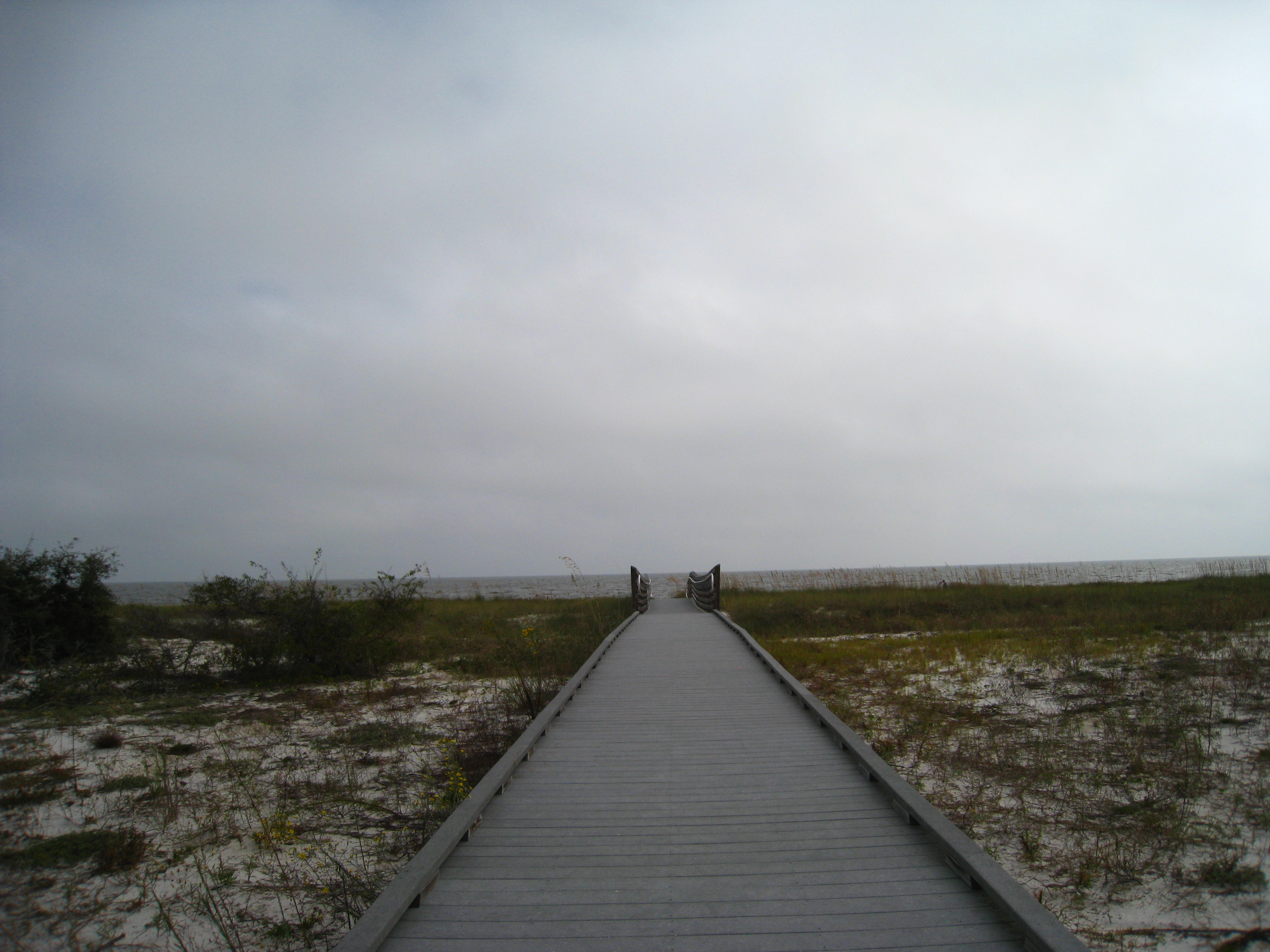 View larger ↗
Bald Point · Katy Warner · CC BY-SA 2.0 · captured 2009-10-30; archival, not current conditions or access.
Taken: 2009-10-30Bald Point · Katy Warner · CC BY-SA 2.0
Resized/cropped for display; original colors retained. Adaptations retain the stated license.
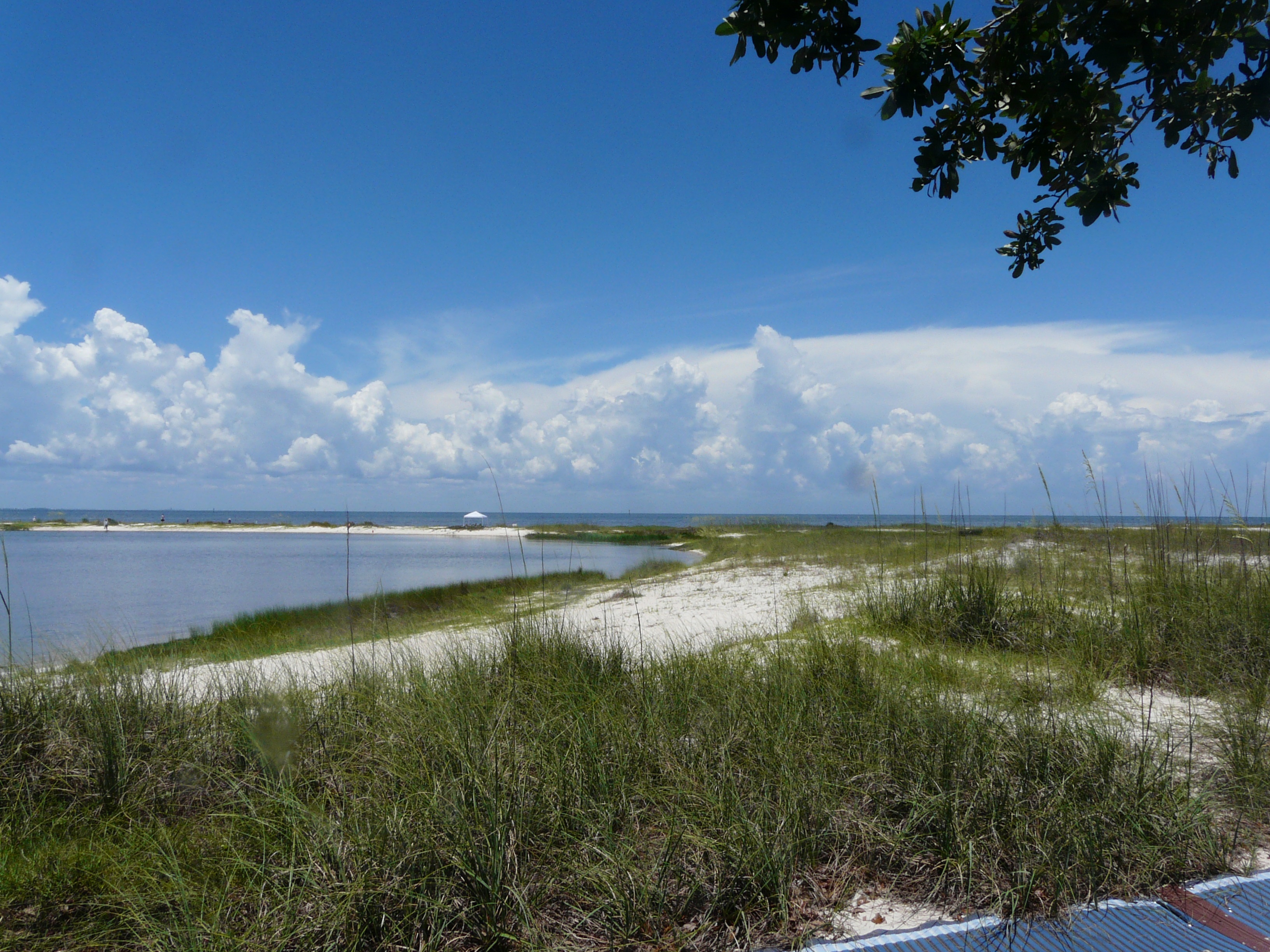 View larger ↗
Bald Point lagoon and Apalachee Bay · The Bushranger · CC BY-SA 4.0 · June 25, 2021; archival, not current access or conditions.
Taken: 2021-06-25Bald Point lagoon and beach · The Bushranger · CC BY-SA 4.0
Resized/cropped for display; original colors retained. Adaptations retain the stated license.
Food, stays & rentals
EXTEND YOUR BEACH DAY
Food & drink nearby
Local dining recommendations
marina dock dining
Tiki on the Point
Tiki on the Point is at Alligator Point Marina’s docks. Confirm current service and use the road transfer from the public beach or state park; it is not a sand concession.
Visit Tiki on the Point website ↗Website & source check
Website checked ↗ · checked 2026-10-06. Menus, opening hours, rates and availability can change; check directly before visiting.
Research notes & location scope
Local dining recommendations: Tiki on the Point is at Alligator Point Marina’s docks. Confirm current service and use the road transfer from the public beach or state park; it is not a sand concession.
Supporting research source ↗ · reviewed 2026-10-05
These listings are unpaid and contain no affiliate links.
Accommodations by the beach
cottages cabins RV sites
Carrabelle Beach RV Resort
Carrabelle Beach RV Resort lists cottages, cabins and RV sites at 1843 Highway 98 West. It is a separate road-transfer base, not on-site lodging at Alligator or Bald Point.
Visit Carrabelle Beach RV Resort website ↗Website & source check
Website checked ↗ · Supporting source 2 ↗ · checked 2026-10-06. Menus, opening hours, rates and availability can change; check directly before visiting.
Before you book
Confirm the exact property or rental unit, view category, beach route, accessibility and total price directly. Nearby lodging does not establish access to a private beach, a boat transfer or permission to camp.
Research notes & location scope
Carrabelle Beach RV Resort lists cottages, cabins and RV sites at 1843 Highway 98 West. It is a separate road-transfer base, not on-site lodging at Alligator or Bald Point.
Supporting research source ↗ · Supporting research source ↗ · reviewed 2026-10-05
These listings are unpaid and contain no affiliate links.
Activities & rentals
Alligator Point Marina provides a working marina; county tourism lists Allegro Sailing’s booked captained sail/fishing outings. Confirm the actual meeting and launch—neither is a public beach concession.
Sources & review dates
commercial activities rentals
Source ↗ · reviewed 2026-10-05
Explore nearby beaches
Review dates & updates
Dates below cover the named fact and its recorded evidence, not an on-site inspection or today’s conditions.
- Hours: evidence reviewed
- Dogs on the beach: evidence reviewed
- Lifeguards: evidence reviewed
- Restrooms: evidence reviewed
- Beach driving: evidence reviewed
- Accessibility: evidence reviewed
- Parking & entry: evidence reviewed
Closure and condition evidence gets the shortest review cycle; fees, hours and seasonal staffing are checked more often than stable geography. Changed or conflicting evidence goes into a scoped review queue. How reviews work
Sources & review date
Guide desk research reviewed 2026-10-05; this is not a field-by-field current verification or an on-site inspection. Official facts, dated agency evidence and editorial assessments retain their own scope. Unknowns and conflicts remain open. Methodology · Rating explanations · Correction history
- Bald Point State Park Beach managing authority ↗
- Bald Point State Park Beach · hours evidence ↗
- Bald Point State Park Beach · dogs evidence ↗
- Bald Point State Park Beach · lifeguards evidence ↗
- Bald Point State Park Beach · restrooms showers evidence ↗
- Bald Point State Park Beach · public access rules evidence ↗
- Bald Point State Park Beach · driving evidence ↗
- Bald Point State Park Beach · parking entry evidence ↗
- Bald Point State Park Beach · accessibility evidence ↗
- Bald Point State Park Beach · sand shoreline evidence ↗
- Bald Point State Park Beach · surf evidence ↗
- Bald Point State Park Beach · water quality evidence ↗
Photo: Bald Point lagoon and beach by The Bushranger · CC BY-SA 4.0. Cropped for display; adaptations retain this license.

Visitor experiences
Original, moderated reviews and photographs. Visit dates and entrances provide context; visitor ratings and reports do not replace official facts or current conditions.
Read approved visitor experiences here when available.