
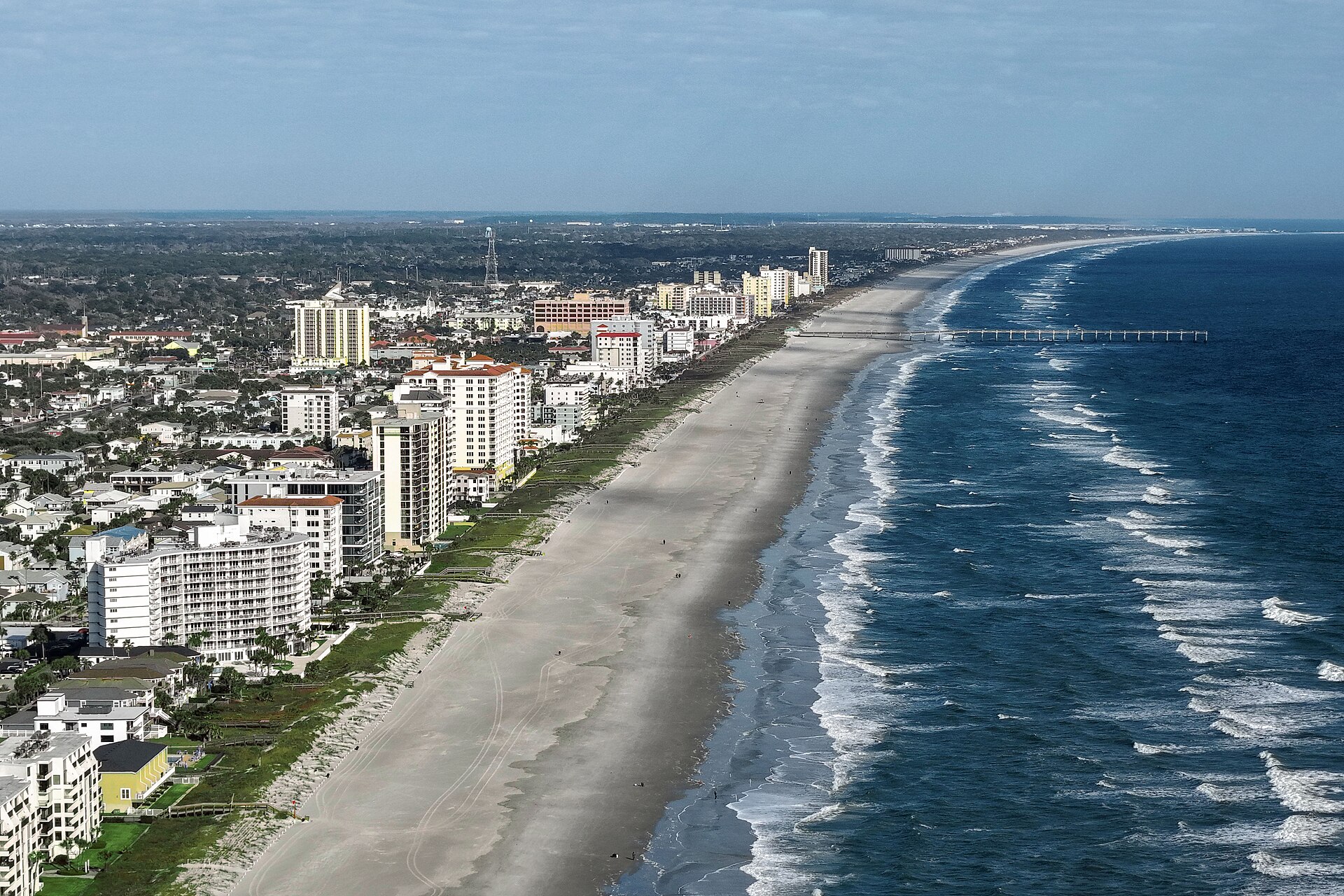
St. Johns County Coast · Florida
Porpoise Point
- State
- Florida
- County
- St. Johns County
- City / community
- Vilano Beach
Vilano Beach is an unincorporated community in St. Johns County; it is not an incorporated city.
Northeast Florida · St. Johns County Coast
Porpoise Point is a named shoreline destination at St. Augustine Inlet. The county lists its vehicle ramp, while also warning that vehicle travel from Vilano to the point may be restricted; follow the current gate and nesting-season signs.
Today at the beach
Weather, surf forecasts, tide predictions and official alerts load when JavaScript is available. All times are local to this beach.
Latest weather
Live observation has not loaded.
Daily forecast
Forecast has not loaded.
High & low tides
Tide predictions have not loaded.
Jacksonville Beach. Nearby coastal reference; timing varies along the coast. Predictions, not measured water levels or safe crossing times.
NOAA tide station ↗NOAA swim & rip-current forecast
The official surf-zone forecast has not loaded.
Forecast risk is not the flag flying at this beach. Conditions can vary within the forecast area.
Official local flag & condition status
Flag color: not currently verified
The county publishes access and driving updates through SJC Beaches. A colored swimming flag is not assumed from those notices.
The Beach Database does not convert weather or a rip-current forecast into a colored flag. Check flags and signs on arrival and ask a lifeguard where available.
Active warnings & alerts
NWS area alerts have not loaded.
Weather alerts do not confirm swimming safety, lifeguard staffing, water quality or beach closures. No alert does not mean safe water.
Water quality
Official beach bacteria testing · Florida Healthy Beaches
No confirmed sampling point for this beach
We have not matched this beach to an official monitoring station. Water quality is unknown here; a nearby beach’s result is not a substitute.
Official St. Johns County results ↗ · About Florida Healthy Beaches ↗
What these results mean
Enterococci are bacteria used to indicate possible fecal contamination. Florida describes 0–35 per 100 mL as Good, 36–70 as Moderate, and 71 or more as Poor. These are periodic laboratory samples, not continuous monitoring.
Samples more than 14 days old are marked older by The Beach Database. This is our freshness reminder, not an official advisory threshold. A “Good” sample or “No” advisory in an older report does not establish today’s conditions.
Testing does not rule out all pathogens, harmful algae, sewage spills or other hazards. Follow current posted advisories and closures. Water clarity, surf flags and bacteria results measure different things.
Vehicle routing at Porpoise Point is condition- and habitat-dependent. Check current county driving updates before entering the sand.
Browse all 171 St. Johns County mapped beach-access records ↗
Admission, payment & passes
Day-use admission
Pedestrian access is not charged. A vehicle entering a designated beach-driving ramp pays $10 daily March–September; reduced $5 daily rates apply to ADA users and active-duty military.
The fee applies to motorized beach entry, not ordinary pedestrian use of public walkovers. Weather, tides and sand can close ramps without refund assurance.
Official fee page ↗Accepted payment
The county’s current page does not specify cash, card or mobile-payment acceptance at toll booths. Confirm with Beach Services before relying on one method.
Pass options
Annual: $50 St. Johns County resident · $100 nonresident · $40 ADA · free for qualifying disabled veterans
Required with the $10 daily option from March 1 through September 30. No pass is required October 1 through February 28, although gates and conditions still control access.
Daily rate: $10; ADA and active-duty military daily rate: $5. Annual and daily passes are sold at designated beach toll booths. The county page does not identify accepted tender, so carry a backup payment method or call Beach Services at 904-209-0331.
Fees and pass terms verified September 23, 2026. Taxes, service fees, discounts and prices can change; review the official checkout before purchasing.
Public or private?
Public access
Who can visit: Open to the general public, including visitors, during permitted hours and subject to posted rules.
Entry route, fees & access boundaries
- Manager / access authority
- St. Johns County
- Access basis
- This listing covers a publicly managed beach access or park, not a private guest-only beach.
- Where to enter
- Use an entry marked Open in the St. Johns County beach-access directory.
- Fees & reservations
- Public access does not establish free parking. See Parking & entry for the researched fee information.
- Restrictions & exceptions
- Use only signed public walkovers, footpaths, parks or vehicle ramps. A GIS record labeled Undeveloped is documented for completeness but is not represented as a visitor-ready entrance.
- What this label covers
- The named park or beach entrance and its designated visitor areas. Adjacent land ownership and exact shoreline boundaries are not surveyed in this guide.
Beach ownership, the route across land, public shoreline-use rights and access to facilities are separate questions. Rules vary by state and location. Use the identified public entrance or documented permission; neither a nearby resort nor an admission fee by itself establishes that a beach is private. A mapped beach is not permission to cross private property.
Access policy reviewed 2026-09-23. Not a live closure report or a property-boundary survey.
Crowd meter
Typical atmosphere estimate · not live occupancy. Local attendance observations needed.
The access inventory establishes routes and parking, but it does not provide enough attendance data for a responsible 1–5 rating.
Busy days, times & seasonsPlan around weekends, holidays and local activity
Days: Planning estimate: fair-weather Saturdays, Sundays and summer holiday weekends are more likely to be busy than ordinary weekdays. No day-by-day attendance series has been verified.
Time of day: Planning estimate: late morning through midafternoon is the main beach-day window. Try the first part of the permitted opening hours for a quieter visit; no measured hourly peak is available.
Time of year: Regional planning estimate: expect more beach-day demand from late May through early September, especially Memorial Day, Independence Day and Labor Day weekends. March–April school breaks can add visitors. Cooler November–February weekdays are a better quiet-time bet, except holidays and events.
Find a quieter visitWhere people gather & when to try
Try a nonholiday weekday early in the permitted visiting hours. Use open public shoreline away from the busiest entrance where practical; do not cross closures, dunes or private property to find space.
Within this beach: Developed parks and the nearest available parking are the likely gathering points.
Quieter does not mean safer swimming or staffed lifeguards. Use posted opening hours, weather guidance and access restrictions when choosing a time.
How the meter works & sources
1 = very quiet; 2 = laid-back; 3 = moderate; 4 = lively / busy; 5 = very busy. Higher means more activity, not a better beach. Ratings compare the general daytime experience near the featured access in fair beach weather, mainly during the warm season outside major holidays. They are editorial estimates based on the evidence described above, not measured occupancy percentages or forecasts.
Weekends, events, tides and the exact part of the beach can change the experience. Parking pressure is distinguished from crowding on the sand. No beach is promised to be deserted. “Unrated” means evidence is insufficient; it does not mean empty. General timing advice is labeled as a planning estimate wherever local attendance data is unavailable.
Reviewed September 22, 2026. No live crowd tracking or hourly visitor counts are connected.
Sand & sandcastles
Coquina-influenced Atlantic sand. Tap a topic for texture, comfort and family sand-play advice.
Color, texture & shellsCoquina-influenced Atlantic sandCounty coastline context; exact access texture not field-tested
St. Johns County describes a coastline of soft sand and coquina shells. Shell concentration and apparent color vary by access, tide, weather and beach work.
Expect dry loose sand above the tide line, firmer damp sand lower on the beach and locally shell-rich patches. No access-specific grain survey was found.
Barefoot comfort, kids & castlesTest a damp, shell-light patchPractical guidance · not a field-tested rating
Underfoot: For a barefoot walk, look for a clear patch rather than a shell line. Bring sandals for hot sand and any rough fragments. Firmer damp sand can be easier to walk on, but does not establish a wheelchair or stroller route.
Sand play: Try a bucket test: damp sand that holds its shape when tipped out is a good starting point. Pick a shell-light patch away from the active surf, dunes and marked nests. Add a little water to crumbly sand rather than building at the water’s edge.
Sand can become hot regardless of color. Check it before children sit or go barefoot. Tides, storms and beach nourishment can change the surface; these descriptions are not live condition reports or swimming-safety ratings.
Use open beach sand, leave dunes and nesting areas alone, fill holes and flatten castles before leaving so turtles have a clear path. FWC beach-care guidance ↗
Desk review: September 22, 2026. Local observations and sand samples are still needed where noted.
Surfing profile
A long-term assessment for this shoreline, paired with the live NOAA surf and wind information near the top of this page.
- Break type
- St. Augustine Inlet point and adjacent Atlantic shoreline
- Best suited to
- Advanced local knowledge recommended
Porpoise Point is dominated by inlet processes and shifting access controls. It should not be treated as a general surf beach; evaluate only a lawful Atlantic-side setup and current route conditions.
Watch for: Severe inlet current, boats, shifting shoals, nesting closures and vehicle-route conflicts.
Current reports, cameras & social updates
Use the newest time-stamped report. A camera or local post can show shore conditions that a regional model misses; an offshore buoy does not equal breaking-wave height at this access.
Editorial suitability rating reviewed September 23, 2026. It describes the location, not today’s wave quality or safety.
SMALL FINDS, GREAT BEACH DAYS
ShellingProvisional · county coquina contextExplore finds & tips
Quality & what to expect
Worth checking tide lines on a shell-influenced St. Johns County shore. The rating is provisional because whole-shell quality has not been measured at this exact entrance.
Shell types & likely finds
Coquina fragments are expected; a reliable access-specific list of intact common shells is still being built.
How to look
Walk the exposed shell lines around low tide and compare several patches of wet sand. Return after rough weather only when conditions are safe. A beach full of fragments may yield few intact shells.
Collect thoughtfully
Leave living or occupied shells and live sand dollars where they are. Stay off dunes and outside wildlife closures. Use surface beachcombing; this guide does not authorize digging or entering restricted land.
Desk review: September 22, 2026
Shark tooth huntingProvisional · regional possibilityExplore finds & tips
Your chances of finding teeth
An occasional-find prospect rather than a documented hotspot. Search dark gravel and shell lines after tides and storms.
Tooth types & likely finds
No access-specific common shark-tooth type list has been verified, so species are intentionally not guessed.
How to look
Slow down at patches of shell grit and scan for small triangular or needle-like teeth. Try exposed tide lines around low tide; finding nothing on a visit is possible even at a well-known beach.
Collect thoughtfully
Leave living or occupied shells and live sand dollars where they are. Stay off dunes and outside wildlife closures. Use surface beachcombing; this guide does not authorize digging or entering restricted land.
Desk review: September 22, 2026
Sea glassQuality, searching & collection rules +
Quality & likely finds
A reliable beach-specific assessment of sea-glass abundance, colors and well-rounded pieces is not yet available. Treat a find as a bonus to a beach walk; shelling or shark-tooth quality does not predict sea-glass quality.
Recognizing & looking for sea glass
Naturally weathered glass often has a cloudy surface and softened edges; some fragments remain sharp. Local color frequencies are unverified. Scan exposed sand and shell lines on a low-tide walk only where access is open. Never add broken glass to the beach, dig into dunes, or pick up sharp fragments barehanded. Report hazardous debris to staff.
May I take it home?
Collection rules unconfirmed. Ask St. Johns County Beach Services about keeping surface sea glass at this access. A general beachcombing description or a ban on bringing glass containers does not settle whether found sea glass may be removed.
Reviewed September 22, 2026. Ratings describe finding or viewing quality; they never grant collection permission. Unrated means evidence is insufficient, not a score of zero.
DriftwoodViewing, collection rules & penalties +
What to expect
The quantity, size and condition of washed-up wood at this beach have not been verified. Driftwood can shift with tides and storms; visible wood is not automatically available to take home.
Looking without disturbing
Photograph interesting shapes where they lie. Do not drag logs, dismantle natural wood piles or disturb wildlife shelter. Keep clear of floating or shifting logs and rising tides; wood trapped in dunes should remain undisturbed.
May I take it home?
Check before collecting. A driftwood-specific permission or prohibition has not been verified for this access. Leave it in place until St. Johns County Beach Services confirms whether removal is allowed and any size, quantity or permit limits. Do not cut trees, detach branches or remove wood from dunes.
Penalties & enforcement
A driftwood-specific offense and applicable penalty have not been established for this beach. No fine amount is quoted; unconfirmed does not mean legal or penalty-free. State-park penalties shown for other beaches must not be applied here automatically.
Reviewed September 22, 2026. Ratings describe finding or viewing quality; they never grant collection permission. Unrated means evidence is insufficient, not a score of zero.
Snorkeling & scuba diving
Ratings are for entering from this beach. Offshore boat diving is assessed separately.
SnorkelingProvisional · shore onlyVisibility, wildlife & rentals +
What to expect
Limited appeal for a dedicated snorkeling trip. This guide has not established a sheltered, reliably clear snorkeling area or a shore-access reef at this beach. A calm day may allow a brief look, but swimming suitability alone does not establish good snorkeling.
Underwater visibility
Variable / unmeasured. No reliable beach-specific underwater visibility range in feet or meters was found. Surf can suspend sand, so surface water color is not a visibility measurement. Confirm conditions locally on the day; no season or tide guarantees clear water.
Fish & sea life
Florida sandy-shore habitat can support pompano, whiting and jacks; striped mullet also inhabit coastal waters. These are regional habitat examples, not a verified list of common underwater sightings at this beach. Beach-specific abundance and other sea-life sightings remain unconfirmed.
Entry, conditions & experience
Use the beach’s posted water-access areas and current flags. Avoid fishing lines, surfers, piers and boat traffic. This rating does not confirm scuba permission or certify an entry route; ask the beach manager before planning a shore dive.
This is not a designated beginner snorkeling recommendation. Go with a buddy; skip water entry when surf, currents or visibility are unsuitable.
Equipment rental nearby
Divers Supply Jacksonville advertises scuba rentals, including tanks, regulators, BCDs and wetsuits, and requires a certification card. Call 904-646-3828 for availability and directions. Mask, snorkel and fin rental availability is unconfirmed. This is an off-beach shop requiring a separate trip, not a verified beach concession or walking-distance rental. Divers Supply Jacksonville: equipment rentals ↗
Scuba divingProvisional · shore onlyVisibility, wildlife & rentals +
What to expect
Limited as a planned shore dive. A recreational shore-entry dive route, depth profile and underwater attraction have not been verified here. Regional offshore reefs should be planned as a separate boat trip with a qualified operator.
Underwater visibility
Variable / unmeasured. No reliable beach-specific underwater visibility range in feet or meters was found. Surf can suspend sand, so surface water color is not a visibility measurement. Confirm conditions locally on the day; no season or tide guarantees clear water.
Fish & sea life
Florida sandy-shore habitat can support pompano, whiting and jacks; striped mullet also inhabit coastal waters. These are regional habitat examples, not a verified list of common underwater sightings at this beach. Beach-specific abundance and other sea-life sightings remain unconfirmed.
Entry, conditions & experience
Use the beach’s posted water-access areas and current flags. Avoid fishing lines, surfers, piers and boat traffic. This rating does not confirm scuba permission or certify an entry route; ask the beach manager before planning a shore dive.
Use a trained buddy and stay within your certification and experience. No recommended shore-dive depth or route is established in this guide.
Equipment rental nearby
Divers Supply Jacksonville advertises scuba rentals, including tanks, regulators, BCDs and wetsuits, and requires a certification card. Call 904-646-3828 for availability and directions. Mask, snorkel and fin rental availability is unconfirmed. This is an off-beach shop requiring a separate trip, not a verified beach concession or walking-distance rental. Divers Supply Jacksonville: equipment rentals ↗
Shore & sky wildlife
Animals on the sand, dunes and in the air, including nesting sea turtles. Underwater species are covered separately in snorkeling and scuba diving.
Birds on the shore & in the skyRoyal terns & pelicans · regional examplesNearby Jacksonville Beach evidence
Royal terns on the sand and pelicans overhead are documented on nearby Jacksonville Beach. They are regional identification examples here; we have not verified which species are most common on this particular beach. Seasonal visitors and flock sizes change.
Sea turtles on the beachLoggerheads · seasonal nestingNortheast Florida context
May–October is the regional nesting season, with loggerheads the most common nesting sea turtle in Northeast Florida. Tracks or marked nests are more realistic things to notice on a daytime walk than an adult turtle. Nesting activity and species at this exact access have not been individually verified.
Other shore & dune wildlifeGhost crabs · habitat exampleRegional habitat; local frequency unverified
Ghost crabs live on Florida’s sandy upper beaches. Look for small burrow entrances in open sand without digging into them. This is a habitat-based possibility, not a confirmed common-animal count at this access.
Wild horsesNo local wild herd documentedSeparate destination
We have not documented a free-roaming wild-horse herd at this beach. The area’s well-known feral horses live on Cumberland Island, Georgia. Horses accompanying riders are domestic animals, not wild beach wildlife.
Accommodations by the beach
Beachfront stays and directly across-the-street options with documented ocean-view room choices. Check both the property’s location and your exact room or rental unit.
Qualifying oceanfront or across-the-street ocean-view accommodation has not yet been verified for this location.
Before you book
Confirm the exact address, view category, road crossings, beach access and current photos. For rentals, verify bedrooms, occupancy, kitchen, parking, minimum stay and which pools or resort facilities are included. Compare the total including cleaning, resort and parking fees, deposits, taxes, pet charges and cancellation terms. Check accessibility directly with the property.
Property descriptions reviewed September 22, 2026; rates and availability are not live. These listings are unpaid and contain no affiliate links. Rental collections are starting points for a search, not confirmation that every unit meets these criteria or is at this beach.
Activities & rentals
Plan an outing at this beach or in the surrounding area. Location labels distinguish beach activities, inland launches and separate regional trips.
Jet ski rentals & toursLocal option not yet verified
We have not verified an operator for this activity at this beach or in its immediate area. This is an information gap, not a statement that the activity is unavailable or prohibited.
Boat rentalsLocal option not yet verified
We have not verified an operator for this activity at this beach or in its immediate area. This is an information gap, not a statement that the activity is unavailable or prohibited.
ParasailingLocal option not yet verified
We have not verified an operator for this activity at this beach or in its immediate area. This is an information gap, not a statement that the activity is unavailable or prohibited.
Fishing chartersLocal option not yet verified
We have not verified an operator for this activity at this beach or in its immediate area. This is an information gap, not a statement that the activity is unavailable or prohibited.
Tours & cruisesLocal option not yet verified
We have not verified an operator for this activity at this beach or in its immediate area. This is an information gap, not a statement that the activity is unavailable or prohibited.
Horseback ridingLocal option not yet verified
We have not verified an operator for this activity at this beach or in its immediate area. This is an information gap, not a statement that the activity is unavailable or prohibited.
Kayaks & paddleboardsLocal option not yet verified
We have not verified an operator for this activity at this beach or in its immediate area. This is an information gap, not a statement that the activity is unavailable or prohibited.
Surf lessons & rentalsLocal option not yet verified
We have not verified an operator for this activity at this beach or in its immediate area. This is an information gap, not a statement that the activity is unavailable or prohibited.
Bikes & beach gearLocal option not yet verified
We have not verified an operator for this activity at this beach or in its immediate area. This is an information gap, not a statement that the activity is unavailable or prohibited.
Operator information reviewed September 22, 2026. Confirm current schedules, prices, weather cancellations, age / skill requirements, accessibility and the exact meeting point before booking. These are unpaid directory listings, not safety certifications. No sponsored placements or affiliate links are currently included.
Allowed & prohibited activities
Rules for this beach. Campgrounds, restaurants and picnic areas may have different permissions.
- Alcohol
- Not allowedNot allowed on the beach
St. Johns County prohibits alcoholic beverages and glass containers.
- Bonfires & beach fires
- Not allowedNo bonfires or open fires
Open fires are prohibited. Self-contained cooking grills are a separate permitted activity: remove all equipment and coals, and never discard coals in the sand.
- Beach camping
- Not allowedNo overnight beach camping
Overnight camping is prohibited. Daytime shade structures may not exceed 10 × 10 feet and must be removed when you leave.
- Shore fishing
- With restrictionsAllowed subject to swimmer safety
County code bars continuing shore or surf fishing after a sheriff or county lifeguard warns that swimmers are endangered. Avoid bathing areas and follow any direction to stop or move.
Shore fishing: licenses & responsible casting
Unless exempt, you need the appropriate Florida saltwater fishing license even when fishing from shore. Eligible Florida residents can obtain a no-cost shoreline license; nonresidents need a nonresident saltwater license unless an exemption applies. A license does not override local closures or swimming-area restrictions.
Check FWC’s current species, size, season and bag limits. Targeting sharks from shore has additional permit and gear requirements. Keep hooks and lines away from swimmers and wildlife, and take discarded tackle home.
Rules reviewed 2026-09-22. Check official notices for temporary closures and burn bans before your visit. Other access, pet and driving rules appear below.
- Hours
- Access-dependent
Use the signed public entrance and its posted hours. County-managed vehicle gates have separate seasonal hours.
St. Johns County · Beach access details ↗ - Dogs on the beach
- Leashed dogs welcome
County rules require dogs to remain on a leash. Remove waste and obey any park-specific restriction.
St. Johns County · Beach rules ↗ - Lifeguards
- No year-round guarantee
Seasonal towers are listed only at selected county beaches. Treat an unstaffed tower as no lifeguard.
St. Johns County · Beach access details ↗ - Restrooms
- Not at every access
Use the county directory to identify parks with permanent or seasonal facilities.
St. Johns County · Beach access details ↗ - Access & beach rules
- County beach rules apply
No alcohol, glass, smoking, open fires, fireworks, overnight camping or drones. Use dune walkovers and remove all belongings.
St. Johns County · Beach rules ↗ - Beach driving
- Mapped ramp; confirm current route
The ramp is listed among authorized vehicle locations, but the county also says no vehicular access is permitted to Porpoise Point from the Vilano beach area. Treat this as a source conflict and check current gate instructions.
St. Johns County · Beach access details ↗Variable sand · 4WD strongly advised
County vehicle access and closure criteria are documented; no ramp-specific stuck rate or firmness survey is available.
Sand & entrance: Weather, tides and recent traffic can leave loose approach sand, deep ruts or limited travel space. A pass and an open gate do not mean the surface is easy.
AWD versus 4WD: The county identifies 4WD requirements at major ramps. Do not assume AWD, low clearance or road tires will handle current conditions. Even 4WD vehicles can become stuck.
Tides, alternatives & avoiding getting stuck
Tides & route: Check the return tide and current county update before entering. May–October county gates generally close 7:30 p.m.–8 a.m.; A Street closes at 5 p.m. year-round.
Before you enter: If the ramp looks loose, deeply rutted or beyond your experience, use an off-beach lot. Do not enter solely because another vehicle did.
What makes driving easier or harder? Firm, compact sand generally offers better support than deep loose sand. Ruts, limited ground clearance, vehicle load and the need to stop or turn can make a short soft section difficult. Wet sand is not automatically safe: it may be saturated, reached by the tide or outside the legal driving area.
Prepare: Check your vehicle manual’s sand-driving guidance. Carry a shovel, traction aids, tire gauge and compressor; use vehicle- and tire-appropriate pressure advice rather than a universal PSI, and restore road pressure before paved-road travel. Keep within posted speed limits and yield to people and wildlife.
If traction is lost: Avoid repeated wheelspin, which can dig the vehicle deeper. Stop and seek suitable recovery assistance rather than pushing farther into soft sand. Check beach-recovery coverage before visiting; do not assume routine roadside assistance or park staff will tow you. Keep people clear of any recovery operation.
General preparation guidance: NPS: general beach-driving preparation (North Carolina) ↗ · NPS: soft-sand vehicle limitations (North Carolina) ↗ · NPS: avoiding wheelspin in sand ↗. These sources explain sand-driving principles; their local permits, speed limits and route rules do not apply to this Florida beach.
Reviewed September 22, 2026. Conditions are not monitored live. No current beach is labeled “low risk” without supporting local evidence.
- Parking & entry
- Access-dependent
The county does not publish a separate general parking count for the point on its current access page.
St. Johns County · Beach access details ↗ - Accessibility
- Public shoreline; route controls apply
Use the mapped Porpoise Point route and never cross dunes, closures or private lots.
St. Johns County GIS · Beach Access layer ↗ - Sand & shoreline
- Coquina-influenced Atlantic sand
County coastline context; exact access texture not field-tested. See Sand & sandcastles for details.
St. Johns County · Beach access and coastal descriptions ↗ - Surfing
- Inlet point · surf only on a suitable Atlantic-side setup
St. Augustine Inlet point and adjacent Atlantic shoreline. Advanced local knowledge recommended. See the surfing profile and current reports for details.
Surf Station · St. Augustine daily local surf report ↗ - Water
- Atlantic Ocean
Surf, currents and clarity change with weather, tides and inlet proximity. This is not a live safety report.
Food & drink nearby
Nearby dining is still being researched. No recommendations have been added yet.
Check before you go
This guide does not report current swimming safety, lifeguard staffing or closures. Follow posted signs and local lifeguard instructions.
Sources & review date
Desk research reviewed 2026-09-23. Unconfirmed details remain labeled. This is not an on-site inspection.
Photo: Jacksonville Beach, Florida.jpg by Quintin Soloviev · CC BY 4.0. Cropped for display; adaptations retain this license. Regional photograph, not this specific beach.
